Exploring the Majestic Tergo La Trek in Bhutan: A Journey of Natural Splendor.
Tergo La is located in Bhutan. It consists of scenes such as valleys, mountain paths, rivers, forests, and farmland. It is a place to behold. This article is developed to help you appreciate the history of Tergo La Trek and its beautiful sight. It will also explain the trekking Tergo La process and its potential dangers in detail.
Brief History
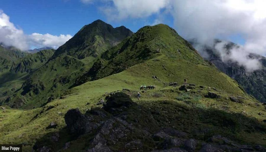
In 2015, the Tergo La Trek in Bhutan was first made accessible to tourists. Hikers are transported through the Haa Valley and across the Tergo La pass. This area is located at a height of 4,850 m (15,912 ft). Beautiful vistas of the Himalayan Mountains, including Mount Jomolhari and Mount Jichu Drake, may be seen while on the trek.
It has been suggested that local peasants have used the path as a commerce path between Haa and Paro for centuries. The journey has grown more well-liked among tourists in recent years due to its breathtaking landscape. The Tergo La Trek became accessible to tourists in 2015 thanks to the Bhutan Tourism Council (TCB). Since then, the TCB has marketed the trek to draw more tourists to Bhutan. CNN Travel listed the Tergo La Trek among the top 23 hiking routes in the world in 2023.
Description of the Sight
The majestic Jhomolhari and Jitchu Drake peaks and the surrounding Himalayan ranges may all be seen from the Tergo-La pass. A modest and typical Bhutanese village and a temple honoring the local deity, Tsheringma, are also located near the pass
Despite being remote, the pass is reachable by road, and travelers interested in Bhutan’s breathtaking landscape and rich history frequently visit it. The Tergo-La pass may prove tricky to drive across, though, and calls for knowledgeable drivers and well-kept vehicles due to its high height and steep inclines.
In a nutshell, the Tergo-La Pass is a breathtaking location that beautifully displays the distinctive nature and history of the Haa district and is a must-see for anybody traveling through Bhutan.
Some of these beautiful sights are highlighted below:
- Haa Valley: The Haa Valley is a colorful, green valley with several species of wildlife and plants. It is a lovely area for hiking and exploring.
- Mount Jomolhari: This is commonly called “The Mountain of Snow Maidens.” It is one of Bhutan’s most revered mountains. The sight of it is breathtaking, particularly when viewed from Tergo La pass.
- Mount Jichu Drake: Another stunning mountain that can be viewed from the Tergo La crossing is Mount Jichu Drake. The snow lion, an imaginary creature in Bhutanese mythology, is claimed to reside there.
- The Pamo River: The Haa Valley is traversed by the crystal-clear, azure Pamo River. The area is well-liked for sunbathing and canoeing.
- The Sakteng Wildlife Sanctuary: This is a protected region where several wildlife, such as black bears, snow leopards, and takins, can be found. It is an excellent place to see wildlife.
Ways to Get There
Haa, a rural valley in western Bhutan, is where the Tergo La Trek begins. Paro International Airport, roughly three hours from Haa, is the closest airport. You must first fly into Nepal’s capital, Kathmandu, and then board an additional flight to Paro because there are no direct flights from countries other than Bhutan to Paro.
You must change to a van or cab to get to Haa after arriving in Paro. The distance traveled by bus and taxi takes roughly 4 and 2 hours, respectively.
You must climb for approximately one hour to get to the Tergo La Trek’s starting point from Haa town. The town of Katsho is where the trek begins.
The abovementioned ways to get to Tergo La are simplified into the following bullet points.
- Land at Paro International Airport in Bhutan.
- Travel to Haa Town by bus or cab.
- To get to the trailhead of Katsho Hamlet, you need to hike for approximately one hour.
- Begin your journey.
Details on hiking Mount Toubkal
One of Haa’s most breathtaking and popular hiking trails is Tergo-La Trek. The journey begins in Haa and concludes there.
Because to the country’s relative remoteness and the demand for visitor permissions, Bhutan’s trails are beautiful and ready for exploration. One of the less popular trails in the nation is Tergo-La Trek, located in the Haa Valley.
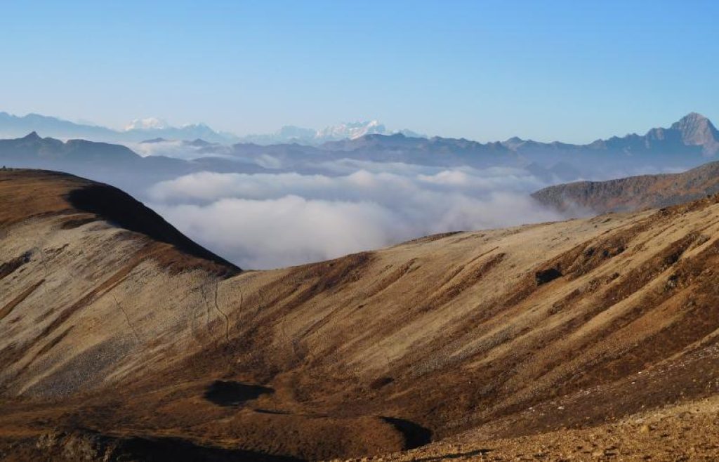
Tergo-La, which translates to “hidden treasure door” in Dzongkha, is a hike that lives up to its name by taking hikers through enchanting, remote trails that pass through picturesque farmlands, pine forests, and steep mountain paths while providing views of Mt. Kanchenjunga, the third-highest peak in the world. The somewhat nomadic yak farming groups are the only ones who utilize the path, which is undeveloped and receives very little traffic. The Tergo-La trek’s height varies between 3500 m to 4150 m and will test the physical and mental stamina of hikers.
When to Go: Weather and Season
Tergo La Trek is best visited in springtime (March to May) or autumn (September to November). These times of year see moderate weather and no snow on the paths. Other noteworthy tips about each of the seasons in Tergo La are mentioned below:
Springtime (March to May): The climate is pleasant and sunny throughout this time of year. The blossoming plants are richly flourishing, and the trails are snow-free. There are, however, some drawbacks to this season. This is Tergo La Trek’s busiest time of year, so it might be packed. It’s possible that lodging and other services will cost more.
Autumn (September to November): The climate is still pleasant and sunny throughout this time of year. The trails are snow-free. The crowds have diminished. But given that the hours of daylight are shortened and the hours of darkness are colder, this season might not be ideal for you.
Winter (December to February): The walk is less popular during this time of year. There can be cheaper rates for lodging and other services. With mountains covered in snow and crystal-clear skies, the surroundings are breathtaking. It does, however, have drawbacks, much like previous seasons. It may be chilly and snowing outside. The trails could be icy and hazardous. You can survive this season if you are adequately ready for weather conditions and high elevations.
The ideal time to visit Tergo La Trek ultimately relies on your preferences and the trekking experience you’re searching for.
Accommodation
Trekkers on the Tergo La Trek have a variety of decent lodging places when they arrive. These lodging places consist of:
Hotels: There are several lodging options in Haa town and a few in the communities along the trip. Private rooms, hot baths, and restaurants are just a few of these hotels’ services.
Homestays: Haa Valley is home to a handful of homestays. Homestays are a terrific opportunity to get to know the locals and explore Bhutan more authentically.
Camping: The Tergo La Trek also offers the option of camping. There are a few campgrounds along the pathway, and if you have the right equipment, you may camp in the wilderness.
The price of lodging in Haa Valley varies according to the kind of lodging you select. The most expensive choice is a hotel, followed by lodges and homestays. Although camping is the most affordable choice, it’s vital to consider the cost of supplies and transportation.
Booking your lodging in Haa Valley in advance is crucial, especially if you intend to hike during the busiest months (March to May and September to November). Due to their propensity to fill up rapidly, hotels and lodges are particularly affected by this.
Food and Water
Maintaining a healthy diet and fluid intake is crucial when hiking a long distance. Similar to how a rumbling in your stomach does not always portends good news, so does a rumbling in the mountains. You want to trek comfortably, meaning you need nourishment and energy. Responsible dietary choices and hydration help you maintain proper muscular function, maintain mental focus on challenging terrain, and refresh yourself on hot days.
A balanced diet is recommended, which excludes processed foods and calls for regular hydration.
Foods and drinks can be found on Tergo La. These items are available at stations along the route. You may still bring your food, though. To prevent getting sick, ensure food is thoroughly prepared and properly covered.
Tergo La Trek water is generally safe to drink. Additionally, it is advised that you carry your water or boil the water before using it. Iodine tablets and a water filter can both be used to purify water.
Challenges When Hiking Tergo La Trek
In as much as Tergo La Trek is an exciting and rewarding journey, it has its challenges that sometimes scare people from attempting it. These challenges are as follows:
Altitude sickness: A typical issue at high altitudes is altitude sickness, which can be highly dangerous. Headache, nausea, throwing up, dizziness, and difficulty breathing are signs of altitude sickness. Consuming lots of water and ascent to high elevations is imperative. It is also crucial to descend quickly to a lower altitude if you start to develop symptoms of altitude sickness.
Cold Weather: High elevations can experience freezing weather, particularly at night. Please make sure you pack a sleeping bag rated for chilly weather and dress appropriately.
Physical stamina: The Tergo La Trek is strenuous. Before beginning the walk, examine yourself to see if you are in the best physical shape. You will need to have enough physical strength to trek Tergo La.
Mental preparation: The Tergo La Trek is challenging, and it is vital to be mentally prepared for the challenges. It is also important to set realistic expectations and to be patient.
Tips to know when hiking Tergo La Trek
- It is recommended that all travelers have travel insurance that includes medical coverage.
- Similarly, we advise you to ensure the insurance covers any activities you plan to engage in while engaging on the Tergo La Trek.
- When visiting Tergo La, there is no requirement to get any additional immunizations. However, it would help if you spoke with your doctor about receiving a vaccination against tropical illnesses.
- If you intend to go high-altitude hiking or mountaineering while visiting Tergo La, you are advised to enroll in fitness training programs.
- When dining out, remember to make sure that vegetables and fruits have been rinsed in distilled water or have been peeled. Food that has spent much time outside in the open should be avoided.
- Always choose boiling and then chilled water, treated water, or sealed water from a reputable brand to ensure that the water you drink is pure.
- Always have a water bottle when trekking or leaving the city/town.
- When you visit Tergo La during the summer, always have repellent on hand and use it.
Potential Dangers
There are potential dangers of hiking Tergo La Trek. Some of these potential dangers are mentioned below:
Rash: Rashes are frequent on the Tergo La Trek, particularly if you are sweating a lot. Maintaining clean, dry skin is crucial, and use the rash ointment as soon as you start to develop a rash.
Slick trails: The Tergo La Trek’s trails can be dangerous, especially after rain or snow. Trekking poles should be used, and caution should be taken.
Wild creatures: Numerous wild animals, such as snow leopards, polar bears, and takins, can be found nearby. While trekking, staying alert to your surroundings and making noise is vital. Any wild animals you may run into will be scared off by this.
Infrastructure Deficit: The Tergo La Trek has less developed infrastructure than other, more well-known hiking locations. Due to the lack of lodging, amenities, and supplies along the route, trekkers must be self-sufficient and well-prepared.
Conclusion
The Tergo La Trek is a trip you are not likely to forget. Hikers looking for a challenging and rewarding experience might consider the Tergo La Trek. Although it is a difficult journey, the benefits are worthwhile. The people are friendly, the historical heritage is rich, and the scenery is breathtaking. The Tergo La walk is a fantastic choice if you’re searching for a demanding yet rewarding walk in Bhutan.
Exploring the Majestic Tahoe Rim Trail: A Hiker’s Paradise in the United States.
The Tahoe Rim Trail, nestled amid the stunning landscapes of the United States, provides an unrivaled outdoor experience for nature aficionados and adventure seekers alike. This 165-mile trail winds its way around Lake Tahoe, passing through lush woods, alpine meadows, and steep hills.
Photo by Rebecca Cook
We’ll delve into the mysteries of the Tahoe Rim Trail in this detailed tour, studying its history, attractions, obstacles, and the unique beauty it reveals.
Brief History
A 165-mile single-track trail called the Tahoe Rim Trail (TRT) surrounds Lake Tahoe in California and Nevada. Glenn Hampton, an outdoor recreation officer with the U.S. Forest Service’s Lake Tahoe Basin Management Unit (LTBMU), made the initial suggestion in 1978. The route was finished in the month of September 2001, with construction formally starting on the fourteenth of July 1983. This construction was done by volunteer labor.
A hardworking team of volunteers worldwide developed the Tahoe Rim Trail. Over 10,000 individuals worked on the project for more than 200,000 hours. The volunteers were of different ages. Some as young as 8, others as old as 80. They also came from different backgrounds. They overcame numerous obstacles while working in a variety of weather conditions. But their perseverance and tireless effort paid off, and today, the Tahoe Rim Trail is among the most well-liked hiking routes on the planet.
Description of the Sight
As mentioned at the beginning of this article, the Tahoe Rim Trail runs for 165 miles around Lake Tahoe. This trail covers two states, six counties, one park, three national forests, and three wilderness areas. Forty-nine miles of it cross the Pacific Crest Trail. A network of other trails joins the Tahoe Rim Trail. Wildflower exhibits can be seen on or near the TRT as it travels through meadows, conifer woods, rocky slopes, and mountainous terrain.
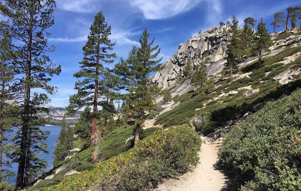
Photo by Rebecca Cook
The TRT is one of the best routes in the world, and it surrounds one of the most picturesque lakes on Earth. When ascending the TRT, you will be exposed to breathtaking views of Lake Tahoe and limitless landscapes to all directions of the compass, from 6,300 ft in Tahoe City to 10,338 ft at the summit of Relay Peak, the elevation changes along the course. The TRT provides access to several creeks, lakes, mountains, and meadows. The variety of ecosystems and altitude provide a wide variety of wildflowers.
Each of the eight trail sections that make up the continuous circle in the highlands above the lake is accessible from ten designated trailheads by car. The lengths of the sections vary from 12.2 to 32.5 miles. Unauthorized entry points offer another way to access the trails. Using the TRT is a terrific opportunity to get outside and enjoy wildflowers, fungal organisms, or fall colors, whether you hike farther or walk only a few kilometers from the trailhead.
Ways to Get There
Drive or bike to one of the ten approved TRT trailheads to access the hilly loop above Lake Tahoe. From there, hikers can explore every inch of the path, which ranges in elevation from 6,300 feet to 10,338 feet, over eight trail segments ranging in length from 12.2 to 32.5 miles. The flora and fauna, as well as the landscapes, are different across this span.
Each turn of this journey causes the eyes to float through stretches of surreal splendor.
You don’t have to be an experienced hiker to take on this trek. All levels of hikers can successfully complete the TRT. Despite the length of the trails, visitors can enjoy the scenery for as long as they can before returning to the trailhead. You can also bring your pet as long as they behave themselves and are cared for when they make things messy.
It should be noted that mountain bikers and horseback riders can also reach some parts of the TRT. Finding out which trails are for hikers to have a smooth journey is recommended.
Details on hiking Tahoe Rim Trail
The California-Nevada border is crossed twice along the Tahoe Rim Trail (TRT), used by trekkers, travelers in backpacks, bike riders, and horseback riders. The trail’s elevation ranges from 6200 feet in Tahoe City to Relay Peak’s 10,338-foot summit.
For mountain cyclists, the track offers a range of terrain and difficulties, including some parts with an elevation rise. Amazing ridge rides above granite peaks, easy single track through lush green meadows, and breathtaking sights of one of the world’s cleanest water sources are all found here.
The only stretch of the TRT that needs a permit is the Desolation Wilderness section. Fortunately, the Lake Tahoe Basin Management Unit offers permits expressly to thru-hikers that avoid the standard DW permit procedure because it’s such a popular spot to travel.
When to Go: Weather and Season
Although summer is lovely, wildflowers can be best seen between July and mid-October. When the temperature drops between September and October, fall colors are visible. Watch for young animals and plants emerging through the spring and early summer landscape. The TRT website contains a detailed explanation of each trailhead and what may be observed there.
The Tahoe Rim Trail is always open; snow-covered sections are frequently harder to access and need cross-country skis or snowshoes.
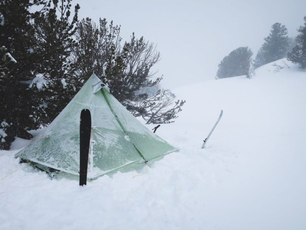
Photo by Justin Lichter.
Accommodation
Suitable shelters may not be available on the Tahoe Rim Trail. However, on the majority of the path, dispersed camping is permitted. Please take note that it is not permitted to camp at trailheads.
Three established rustic campgrounds—Marlette Peak, Hobart, and North Canyon—are the only places where camping is permitted within the Lake Tahoe Nevada State Park. This area is a region on the lake’s eastern shore). Along the Tahoe Rim Trail, several campgrounds provide an affordable choice for lodging. The Tahoe Meadows Campground, Spooner Lake Campground, and Brockway Summit Campground are well-known campgrounds.
There are two hostels in South Lake Tahoe, which is a nice spot to resupply, but no shelters are on the trail. For those arriving by plane or train for their thru-hike, there is a lodging facility in Truckee and another in Reno. The Hyatt Regency Lake Tahoe Lakefront Resort, the MontBleu Resort Casino & Spa, and the Heavenly Mountain Resort are just a few hotels and motels close to the Tahoe Rim Trail. These hotels provide a range of facilities, such as restaurants, fitness centers, and swimming pools.
Food and Water
Along the Tahoe Rim Trail are a few locations where you can buy food and drink, but it’s best to pack your own supplies. Some of the locations where you can obtain food and water are mentioned below:
Trailheads: The majority of trailheads feature water fountains and bathrooms. Small shops that offer food and beverages are also present at certain trailheads.
Camping areas: Most camping areas along the path offer shops for groceries and water.
Resupply locations: You can purchase food and beverages at a few resupply locations along the path. These replenishment locations are frequently found at trailheads or campers.
Lakes and streams: You can discover water from lakes and streams along the walk. Before consuming the water, it is crucial to filter or cleanse it.
It is significant to remember that there are portions of the Tahoe Rim Trail where supplies such as water and food are difficult to come by. These sections of the path are frequently seen in farther-flung locales. Having a lot of nourishment and fluids with you is crucial if you intend to hike in these locations.
Challenges When Hiking Tahoe Rim Trail
Some of the challenges of hiking the Tahoe Rim Trail include the following:
High elevation: The TRT has a 24,400-foot elevation gain, which is a substantial amount for a 165-mile path. This implies that you will be undertaking a lot of challenging uphill hiking.
Wide range of landscapes: The TRT travels across various landscapes, including alpine slopes, woodlands, and meadows. This implies that the terrain you hike will vary, involving rocks, dirt, and tree roots. This can be difficult if you’re unfamiliar with hiking on uneven terrain.
Weather: The weather in the Tahoe region is erratic and subject to sudden shifts. This may make hiking the Tahoe area unfavorable. To overcome this challenge, you must be ready for all types of weather, such as rain, snow, and strong winds. You also need to be appropriately clothed.
Wildlife: A variety of animals, such as bears, mountain lions, and deer, live in the Tahoe region. To prevent contact with wildlife, you must be conscious of your environment and adopt safety measures.
Tips to know when hiking Tahoe Rim Trail
- Begin small: Begin with shorter hikes along the trail if you are not accustomed to big hikes. You can do this to increase your stamina and get ready for more strenuous hikes.
- Group hiking: It can be beneficial if it is your first time on the route. A group can offer companionship and support when you are lonely. Discussions within the group can serve as a forum for learning. It may also be helpful in emergencies.
- Recognize your surroundings: The Tahoe region is home to various species, so it’s critical to be conscious of your surroundings and take safety measures to prevent wildlife encounters.
- Examine the weather before heading out: The weather in the Tahoe region may be erratic, so looking at the forecast before going on a hike is crucial. Well, sometimes forecasts can be wrong. So what you may have to do is to be weather-ready. You should take some sunscreen just in case the weather is hot and rain gear in case it rains uncontrollably in order to cope with the unpredictable weather.
- Pack the required equipment: Pack the essential hiking supplies, such as food, water, a first-aid kit, a map, and a compass.
- Take breaks: It is crucial to pause when hiking, especially if you’re covering a lot of ground. Taking breaks will assist you greatly in staying hydrated and active throughout the drek.
- Get the right equipment: The TRT is a demanding and lengthy hike; therefore, it is crucial to have the right equipment. This entails a sturdy backpack, hiking shoes, and abundant water and food.
- Follow the “Leave no trace” principle: Since the TRT is a well-traveled path, it’s crucial to conceal your existence. This entails taking out all of your waste and being environmentally conscious.
- Recognize the laws and regulations: Hiking in the Tahoe region is subject to several laws and rules. Before you go trekking, ensure you are aware of these guidelines and adhere to them.
Potential Dangers
Some of the potential dangers of hiking the Tahoe Rim Trail are as follows:
- Navigation and orientation: The Tahoe Rim Trail travels across various terrains over a span of about 165 miles (265 kilometers). You must be skilled in navigating and always have a detailed map, a compass or A GPS gadget with you. It can be perilous to become lost or confused, especially in isolated locations with poor cell phone coverage.
- Limited Water Sources: During dry weather, several portions of the path may have limited water supply. This can pose a danger, especially when you are in dire need of water either to quench your thirst or to use it for something else. To carry sufficient fluids between dependable sources, hikers need carefully arrange their water refill stations. To prevent waterborne infections, it’s crucial to sterilize or filter water that comes from natural sources.
- Remote Locations: Some parts of the trail are out in the wilderness and distant from help. It could take some time for aid to come in the event of an emergency or injury. A fully equipped first aid kit, fundamental wilderness survival techniques, and a strategy to send messages or warning signals are all essential.
Conclusion
The Tahoe Rim Trail is a haven for outdoor enjoyment. It makes access to a staggering variety of geology, vegetation, and animals possible.
It is an exceptional hiking location that offers unmatched wilderness experience, physical challenge, and natural beauty. For outdoor enthusiasts seeking adventure and seclusion, it may be an unforgettable experience with careful planning and preparation.
Hiking the Pennine Way, United Kingdom
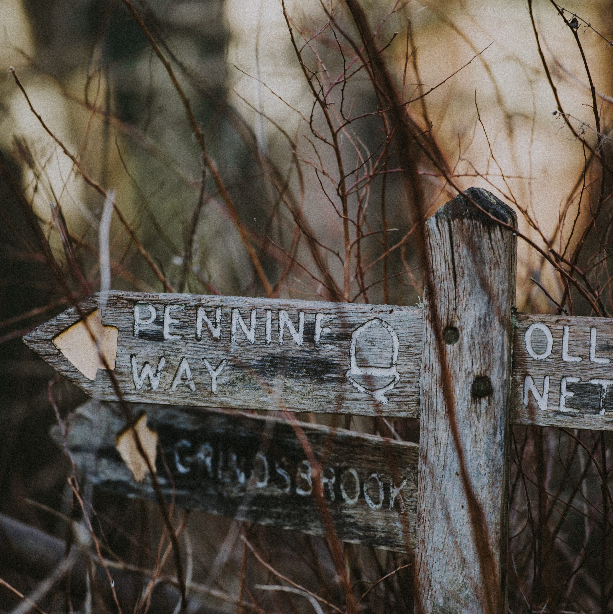
Photo by Annie Spratt on Unsplash
The renowned long-distance Pennine Way winds across the untamed Pennine Mountains for around 268 miles (431 kilometers) in England. It was founded in 1965 and offers hikers a challenging and spectacular journey across many environments, including moorlands, valleys, and historic cities.
The trail’s unique combination of natural beauty and cultural history has made it a popular destination for outdoor enthusiasts seeking an exceptional journey. About 150,000 hikers complete the Pennine Trail annually. Here are some things you need to know to be a part of it.
Brief History of Pennine Way
The Pennine Way was officially inaugurated on April 24, 1965, making it the first designated National Trail in the United Kingdom. Its history extends back to the middle of the twentieth century. Tom Stephenson, a journalist and outdoor enthusiast, was the first to propose creating a long-distance trail over the Pennine Mountains in the 1930s.
It was the first officially installed National Trail in the United Kingdom. Its historical significance and recognition among hikers have benefited from this early popularity. The Pennine Way has built a strong reputation among hikers, nature enthusiasts, and adventurers, drawing people worldwide to enjoy its challenges and rewards.
The sight in Pennine Way
For nature lovers and thrill seekers, the Pennine Trail is a fascinating path that travels through the breathtaking landscapes of Northern England. This trail, which spans 429 kilometers (267 miles) of spectacular scenery, presents a unique chance to interact with nature while immersing oneself in the area’s rich history and culture.
The Pennine Trail is like walking into a real-life postcard. The voyage starts among the undulating hills and verdant meadows, where every bend exposes a different scene that is more enthralling than the last. You will pass by lovely villages, quaint market towns, and historical sites that witness the region’s colorful past as you travel through this picturesque area. The trail’s well-planned route will take you past historic woodlands, serene reservoirs, and harsh moorlands, each of which is attractive.
The trail’s varied flora and animals are among its most distinctive qualities. Nature lovers will savor the chance to see uncommon bird species, vivid wildflowers, and occasionally even grazing animals. From the colorful blossoms of spring to the flaming foliage of autumn, the changing seasons paint the environment in an ever-evolving palette. The Pennine Trail offers an unlimited variety of subjects for photographers and artists to record and preserve.
The Pennine Trail is a must-visit location for many reasons besides its stunning natural surroundings. The route passes through towns that have managed to hold onto their distinctive past, giving visitors a genuine look into the locals’ customs and way of life. Along the journey, charming taverns and warm inns provide opportunities to sample regional food and talk with locals and other travelers.
You can’t help but experience a strong sense of connection to the land and its inhabitants as you follow in the footsteps of earlier generations. The Pennine Trail promises a memorable experience that will leave an indelible stamp on your heart and spirit, whether you’re looking for a strenuous outdoor adventure, a peaceful escape from the hustle and bustle of daily life, or a greater understanding of the region’s cultural tapestry.
The Pennine Way is typically easy to navigate from the ground up. It is not entirely foolproof, though. There is typically a discernible direction at the ground across portions of considerable mountain and moorland, although no longer always. Compass and map skills are necessary.
Ways to Get to Pennine Trail
1. Air: Flying is a quick and easy way to get to the Pennine Way, providing access to this well-known trail. Airports like Manchester or Leeds Bradford, conveniently located near the trail’s starting places, are available to travelers. Although flying is a quick way to get to the area, arranging ground transportation to get you to the trailhead is vital. A seamless transition from the airport to the Pennine Way is made possible by researching, making airline reservations in advance, and planning the appropriate ground transportation.
2. Public transportation: Trains and buses are the primary forms of public transportation that connect many of the towns and cities near the Pennine Way. Regular buses run from Rochdale and Littleborough to the starting point, while trains from Manchester and Stalybridge serve Marsden (the ending point). You can go to surrounding cities by train or bus, then walk or utilize a local transportation option to get to the trailhead.
3 Car: Driving to the Pennine Way gives you more freedom and flexibility and enables you to access trailheads and lodgings that may be farther away. Just remember to factor in parking and, if necessary, rent a car.
4. Shuttle Services: In most cases, commute services or private transportation options are available to drive you to the exact trailheads or pick you up at the end of your trek.
Details on hiking Pennine
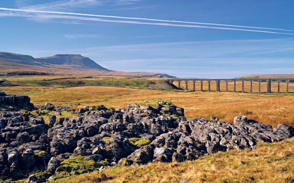
The Pennine Way is a long-distance hiking route in England that connects Kirk Yetholm in Scotland to Edale in the Peak District over a distance of around 268 miles (431 kilometers). It offers stunning scenery, including moorlands, hills, and valleys, and it passes through three national parks. The Pennine Trail can be traversed over two weeks or longer.
The Pennine Way is typically easy to navigate from the ground up. It is not entirely foolproof, though. There is typically a discernible direction at the ground across portions of considerable mountain and moorland, although no longer always. Compass and map skills are necessary.
The Pennine Way is known for its incredible natural beauty and varied landscapes. The trail offers breathtaking views of rolling hills, untamed moorlands, attractive valleys, and endearing settlements to hikers. The Pennine Way’s distinctive and alluring beauty results from its isolation, solitude, and ability to explore rugged terrain and peaceful farmland, making it a typical hiker’s choice.
When to Go: Weather and Season
When the weather is perfect, hiking along the Pennine Trail is a calm yet adventurous experience. This well-known long-distance route travels through some of England’s most magnificent scenery and provides an alluring diversion from the monotony of city life. The trail invites outdoor enthusiasts to enjoy its beautiful charms when the weather cooperates, revealing its splendor.
Early autumn (September to October) and late spring (May to June) are typically the finest times to hike the Pennines. These times usually have great weather and fewer people on the trails. While the summer can be appealing, it’s crucial to be mindful of the possibility of hot and dry circumstances, which could cause pain or dehydration. The cooler temperatures, the danger of slippery areas, and shorter daylight hours of winter also present their obstacles.
Though the Pennines receive precipitation and fast-shifting weather all year, be ready for unpredictable weather. Before leaving, verifying the track conditions and weather prediction is advised.
Accommodation
1. Hotels: Hoppe Valley has a range of lodging choices for hikers, including hotels, hostels, guesthouses, and campgrounds. An illustration is the Britannia Sachas Hotel. Some of these lodgings have self-caterer kitchens.
2. Flexibility: Remember that lodging alternatives along the route might get booked quickly, especially in the summer. Having some flexibility in your plans is beneficial.
3. Glamping and Eco-Lodges: Some lodgings provide yurts, glamping tents, or eco-friendly lodges for those looking for a more abundant or distinctive experience, allowing you to get close to nature without sacrificing comfort; this is nice, but just like any outdoor recreation, you need to pay attention to safety
4. Farm lodge: A few farms along the trail offer lodging, offering a unique chance to experience country life and get close to animals. Activities during farm visits could involve helping with chores or touring the area around the farm.
5. Self-Catering Accommodations: This group of accommodations includes cottages, apartments, and holiday rentals with kitchens or kitchenettes. You can cook for yourself and have a more independent experience with self-catering choices.
Food and Water
1. Snacks for on-the-go: To keep you going between meals, bring a range of small, filling snacks such as dry fruit mixes, energy bars, and dried fruit.
2. Cooking: If you’re camping, consider carrying a compact camping stove to prepare basic meals. The use of freeze-dried food is practical.
3. Filling stations: It could be feasible to fill a water bottle at some homes or public locations. When booking, water dispensers are often available all around the trail, but some might not function, so it is essential to inquire about this.
4. Water purifier: Natural water sources (streams, rivers) must be purified before ingesting. You can use filters, UV sterilizers, or water purification pills to ensure the water is safe to drink. Water purification can enhance the taste, fragrance, and appearance of your drinking water and assist with removing potentially harmful contaminants. Also, be sure to have a backup water source in an emergency, especially hiking in a remote trail area.
Challenges Along Pennine Trail
1. Exhaustion: The trail is over 250 miles (400 km) long and takes many weeks to complete. Hiking over long distances can be mentally and physically taxing. It is essential to keep taking stead breaks to avoid blacking out. Also, Ensure you are in good physical and mental shape before hiking. Hikers should be prepared for a vigorous workout because of the challenging terrain and steep hills.
2. Accommodations: Finding lodging along the trail might be difficult, especially in farther-flung locations. It’s crucial to make early plans and reserve lodging.
3. Navigation: The track is not always clearly defined, and finding your way on vast moorland or in a foggy environment can be challenging. Navigation and map reading abilities are essential.
4. Isolation: Due to some of the trail’s remote locations, hikers may go for extended periods without coming across facilities or other hikers. This solitude can be alluring and complicated, necessitating self-sufficiency and careful planning.
Tips to know when walking Pennine
- The Pennine Way is best traveled from south to north, from Edale to Kirk Yesholm. The majority of hikers travel with the wind and sun at their backs.
- Don’t forget to bring your binoculars since you’ll have fantastic views of the mountains and countryside and plenty of opportunities to see birds, including vibrant singers and perhaps a few kingfishers.
- What is perfect hiking if you don’t have any memorable photos to look back on? Be sure to snap photos of the trail’s breathtaking landscapes and memorable moments, and set aside time to soak it all in simply.
- The Pennines are rough and frequently inaccessible. The landscape varies; some areas have level, firm roads, while others may have narrow, uneven, or muddy roadways. Bring plenty of dry socks and a waterproof jacket, if possible. Wear suitable shoes and clothing because this is a long hike so that you can enjoy it without tiredness.
- Navigational Skills: Become familiar with the trail map and your navigational aids. Knowing how to utilize a map, compass, or GPS device can help avoid getting lost, even with designated paths.
- Know Your Limits: Recognize your degree of fitness and hiking prowess. Be realistic about what you can handle because the Pennine Trail has some difficult stretches.
Potential Dangers
- Weather: The Pennines have harsh and erratic weather. Rain, wind, fog, and snow are possible, especially at higher altitudes. Be prepared. Since there is a severe risk of exposure and hypothermia, dress appropriately.
- Wildlife: Although harmful wildlife interactions are uncommon, you should be prepared for the possibility of running into sheep or calves. You can encounter animals like grouse, deer, and raptors in the back areas.
- Altitude Sickness: This condition is something to be concerned about. Before starting your hike, stay around the Roads’ End trailhead for at least one night to help you adjust (5500 feet). However, it is advised to descend until you feel better and, if possible, try again the next day if you feel unwell.
- Avalanche Risk: During the winter, parts of the track may be vulnerable to avalanches, especially where there are steep slopes and snow accumulation.
Conclusion
An immersive experience amidst the natural splendor of England’s landscapes is promised by traveling the Pennine Way. Adventurers can maximize their time by carefully assessing the weather, choosing the optimum season, and using air transport to reach the trailhead quickly.
A safe and pleasurable exploration of the varied terrains along the Pennine Way is ensured by preparation, packing adequately, and being aware of weather fluctuations.
Every second spent on this well-known trail becomes a treasured memory, whether strolling through springtime wildflowers in bloom or taking in the golden tones of autumn. So take advantage of the chance to explore the delights of the Pennine Way by savoring the peaceful moments, energizing walks, and spectacular panoramas that make this journey unique.
Mount Toubkal, Morocco – A Beautiful Gem
Mount Toubkal is widely known as the highest mountain in the southwestern part of Morocco. It is known for its beautiful landscape and features and is a place for tourism. Indeed, it is a beautiful gem. What makes this place a place of beauty? Are there any challenges of hiking this mountain? How can you get there? When is the best time to go there? You’ll learn about this and much more in this article. But first, let’s look at Mount Toubkal’s rich history.

Photo by Youssef Gahouchy on unsplash.
Brief History Mount Toubkal, Morocco.
The history of Mount Toubkal is significant. The Berber natives of North Africa have lived there for countless years and have preserved a distinctive cultural identity, which may be used to date the region’s history.
According to historical records, some individuals named Vincent Berger, the Marquis de Segonzac, and Hubert Dolbeau led a French climbing team that made the first known ascent of Mount Toubkal on12th of June 1923. However, before this time, there is every possibility that the indigenous Berber population had been ascending the peak for generations. Mount Toubkal in Morocco established itself as a key location for protest against French colonization throughout the 20th century. The charismatic commander Abd el-Krim led the Berber people in guerilla warfare against French soldiers in the highland.
The region surrounding Mount Toubkal is now a well-liked destination for travelers, hikers, and climbers and is acknowledged as a place of cultural and environmental value. The Berber still live a traditional lifestyle and commemorate their rich cultural history via ceremonies, music, and other cultural activities.
Description of the Sight
Although sedimentary rocks make up most of the High Atlas Mountains, Mount Toubkal comprises volcanic boulders that have decomposed into highland crests and are divided by deep, narrow valleys. The mountain descends precipitously to the south for 1,800 meters (5,906 feet), ending in Lac d’Ifni, a small lake.
Trekkers are rewarded with breathtaking views that span the entire High Atlas and Low Atlas Mountains upon reaching the peak. The scene is evidence of the splendor and magnificence of this gem of North Africa, leaving a deep impression on the emotions of all who scale its pinnacle.
Ways to Get There
From the busy city of Marrakesh, Imlil is fairly simple to get to. Because of its proximity to the well-known city, it is frequently regarded as one of the most enjoyable day trips from Marrakech.
HOW TO TAKE A SHARED TAXI FROM MARRAKESH TO IMLIL
Taking a shared cab, or a grand taxi as they are known in Morocco, is the most straightforward method to travel from Marrakesh to Imlil. Only 60 kilometers separate the modest mountain community from Marrakesh; thus, traveling there only takes 75 to 90 minutes.
Once you arrive at this taxi station, you can either reserve the entire taxi for yourself or share it with other customers. The cost will be significantly less if you wait until the taxi is fully fueled.
You can also go to Imlil by taking a bus to Asni and then a taxi if there isn’t a shared taxi going there when you get to the station or if the taxi takes too long to fill up.
HOW TO GET BY BUS AND TAXI FROM MARRAKESH TO IMLIL
The bus ride from Marrakesh to the small town of Asni takes about an hour and a half. From there, it is simple to take a shared taxi to Imlil or hitch the final 17 kilometers to Imlil. From Marrakesh’s main bus station, you can take a bus.
HOW TO DRIVE YOUR CAR FROM MARRAKESH TO IMLIL
You can also drive straight to the small village of Imlil if you own or rent a car. The journey should be pretty enjoyable.
You will go through some stunning scenery on the nearly entirely paved road that leads to the mountain settlement. Although the route there is generally safe, drive cautiously in the winter as pebbles from neighboring cliffs often cover it.
The surrounding area will undergo a thorough transformation as you travel there. You’ll notice a change in the landscape from parched dust to lush, leafy vegetation.
Details on hiking Mount Toubkal
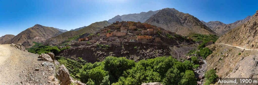
The alpine village of Imlil, where the climb begins, will be where climbers will drop off. On the first day, guests will remain there. Climbers will next travel to the adjacent village of Aroumd for the evening, where they will have dinner and recover in preparation for the following day. The expedition will probably take three to five days, while climbs that include adjacent summits can last up to six to ten days.
The following day, climbers will meet with their guide to get ready for an entire day of hiking. During a span of six hours, they will move across the Ait Mizane Valley, sometimes pausing for quick breaks and chances to capture pictures of the lovely valley.
Visitors must go down narrow, rocky roads, but in exchange, they will be rewarded with breathtaking vistas of distant mountains and trickling waterfalls. Climbers will witness local fauna and the local Berber people in their homes in addition to the landscape.
The ascent will then get steeper—the slope incline increases. As the way to the summit gets closer, it gets more challenging to see, and the stone starts piling up on top of itself. As climbers move closer to the summit, the air becomes thinner; thus, they must pace themselves to avoid being out of breath.
But when climbers ascend higher into the mountain, Toubkal’s expansive views grow more breathtaking. The top is a beautiful place filled with snow, and the mountain surrounding peaks go as far as the eye can see into the distance.
Travelers will unavoidably become the best of themselves throughout their ascent of Mount Toubkal, but they will also be rewarded with stunning displays of beauty.
When to Go: Weather and Season
Mount Toubkal has different seasons. Those who intend to visit should choose the one that works best for them.
Spring
Mount Toubkal has high temperatures of 16.7°C (62.1°F) and minimum temperatures of -1.8°C (28.7°F) from March to May. Moderate snowstorms, minimal precipitation, and pleasant temperatures are to be anticipated.
Summer
Mount Toubkal sees average summertime temperatures of 17°C (64°F) and maximum summertime temperatures of 24.8°C (77°F) between the months of June and August. Typically, July is the warmest month, which makes the mountainous terrain much more difficult.
Autumn
Between August and October, Mount Toubkal experiences high temperatures of 23.5°C (74.3°F) and lowest temperatures of 3.8°C (38.9°F). In the winter, there will be light snowfall and pleasant temperatures.
Winter
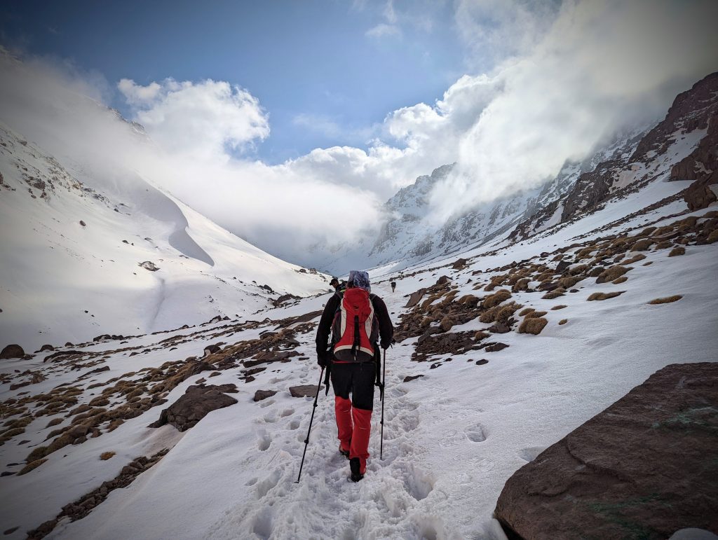
Photo by David Magahaes on Unsplash
The mountain is usually less populated in the winter. However, the situation might be more difficult when the mountain’s lower parts are blanketed in snow. Mount Toubkal has minimum temperatures of -4°C (24.7°F) and average temperatures of 0.4°C (32.7°F) during the months of December and February.
Accommodation
On the ascent to Toubkal, there are two shelters. They are Cabine Alpine Francais (CAF) and Les Mouflons. You can reserve a spot at the CAF shelter or wait until you arrive, as there is always space.
The nightly rate for CAF is 140 Moroccan Dirhams (MAD). You will receive a flatbed as a bunk without bedding at that price. The showers are freezing. Paper towels and detergents are scarce in the toilet. The employees are friendly.
Food and Water
The food served on Mount Toubkal climbs is often essential and nourishing, aiming to give you the energy and nutrients you’ll need for the climb. They frequently serve excellent and varied traditional Moroccan food. You can anticipate foods like couscous, grilled meats, tagines (stews with beef and vegetables that are gradually cooked), and Moroccan soups. The meals are created to offer a healthy balance of protein for muscle development and repair and carbohydrates for stamina. This is crucial to maintaining your energy levels throughout the hike. Dishes, including grains, proteins like chicken or beef, or vegetarian alternatives like legumes or chickpeas, are to be expected.
Using fresh ingredients is a top priority for many climbing companies and guides. Local produce and products are frequently used to give you a taste of the regional flavors and to make sure that the dishes are as delicious and wholesome as possible.
To maintain nourishment and energy throughout the walk, snacks like fruits, nuts, energy bites, and cookies may be offered in addition to the major meals. Snacks should always be on hand to help you stay energized throughout long trekking days.
Let your trekking company or guide know in advance if you have any special dietary needs or limitations. They will do everything possible to meet your needs and offer suitable substitutes. The availability of meals might be restricted in the highlands than in metropolitan areas due to the lack of resources and facilities.
Water for drinking is available when climbing Mount Toubkal. It’s crucial to remember that the accessibility of drinking water can differ based on the route and the particular lodgings or camping grounds along the journey.
While trekking, you might encounter freshwater sources like rivers, streams, or springs. These springs typically offer fresh mountain water that can be consumed with the proper purification. You can get advice on the suitableness and safety of these freshwater sources from your guide or trekking company.
To ensure that the drinking water is safe, it is advised that you carry your own water purifying equipment. This can be accomplished with portable water purification equipment, filters, or water-purifying pills. Any dangerous parasites, viruses, or bacteria in the water are removed using these techniques.
Carrying bottled water with you on your walk is an additional choice. You can buy bottled water before climbing in the cities or villages or at specific rest points. However, bear in mind that in outlying places, the cost or accessibility of water in bottles may be higher.
Bringing a reusable water bottle to reduce plastic waste and provide an ongoing clean water supply is strongly advised. Some hikers find it helpful to carry water bottles or hydration bladders in their backpacks, which enable them to consume water through an opening without stopping. This may prove a helpful choice while on the walk.
Staying hydrated is crucial throughout your trip up Mount Toubkal, especially at higher elevations where the atmosphere is harsher, and thirst is more likely to happen.
Challenges When Hiking Mount Toubkal
Toubkal presents a considerable challenge to seasoned hikers, even though it is primarily a straightforward climb that does not call for strings, helmets, or boots. For people who are not accustomed to the crisp air associated with height or are not in excellent shape, the mountain’s altitude can make climbing to the peak challenging. This climb is doable for anyone with an intense sense of thrilling activities, who doesn’t mind getting a little dirty, and who enjoys hiking along an alpine track.
As mentioned earlier, Toubkal is primarily a simple ascent; however, walking next to the summit below can be difficult due to loose gravel on the peak’s top slopes. Hikers can easily climb up this debris and rock throughout the summer, but snow and icy conditions can make the climb more challenging in wintertime. It might be necessary to climb to the peak during those periods of the year using an ice pick or boots.
Tips to know when hiking Mount Toubkal
- There are several routes up Toubkal; pick the one that works best for you.
- Half the battle is won with proper planning. You need to train to hike Mount Toubkal.
- When climbing Mount Toubkal, be careful of the signs of altitude sickness.
- Make sure you visit Mount Toubkal when the season is right for you.
- Get ready for a terrible night in the Refuge
- Respect and acclimatize to the local culture
- Be generous with your money, especially to your guides who assist you in climbing Mount Toubkal.
- Reserve your trip with a reputable trekking organization
Potential Dangers
There are potential dangers when hiking Mount Toubkal. These dangers are explained below:
- Altitude sickness: At the highest point, breathing sufficiently to enjoy the hike is challenging. Many people could start to feel uneasy or get sick with a fever, nausea, or stomach discomfort. In extreme circumstances, it might potentially result in death.
- Fatalities and Injuries: Accidents happen no matter how proficient you are. You risk suffering a major injury with only one misstep. Therefore, hikers should exercise caution and restraint when ascending Mount Toubkal.
- Change of Weather: No one has any influence over the weather. Both possibilities are the intense heat that hikers find intolerable or the bitter cold that makes hiking uncomfortable. The proper attire can make it easier to adapt to changing weather.
Conclusion
Adventurers are invited to climb Mount Toubkal’s towering heights and discover the beauties of Mount Toubkal. Mount Toubkal serves as a symbol of Morocco’s breathtaking scenery and rich history. The climb to Toubkal’s peak offers an exciting and gratifying experience, providing guests with memories to treasure for a lifetime, whether hiking in the warmer months or skiing climbing in the winter.
Hiking the Great Wall of China– Jinshalling Section
It is no news that the Great Wall of China is one of the the seven natural marvels of the World. However, this Great Wall is not a wonder without its different sections. The Jinshanling section is one of those sections that many tourists and hikers visit.
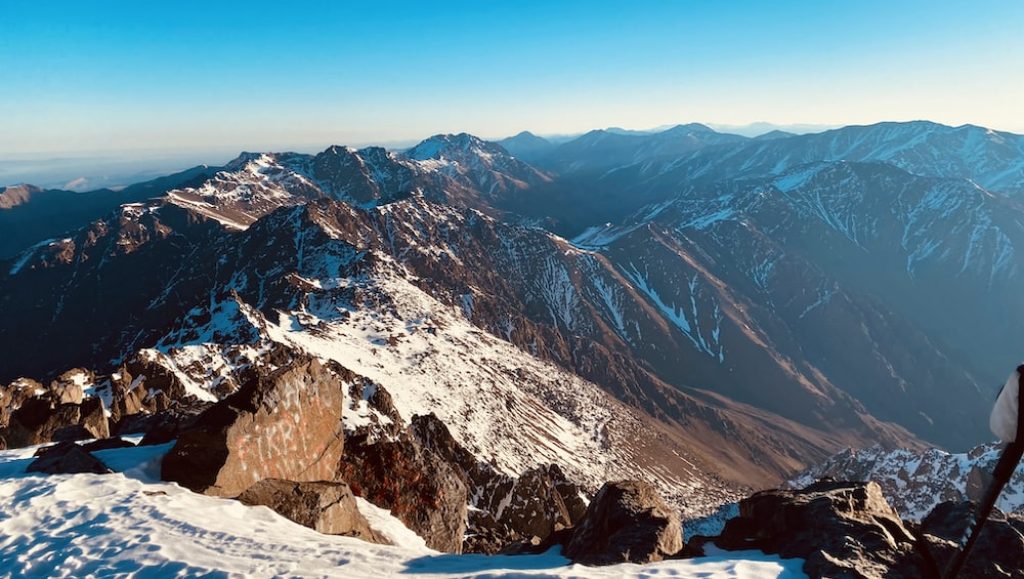
Photo by William Olivier.
This article will reveal the history of the Jinshanling section, describe its sight, give details of food and accommodation, and let you know of the challenges of hiking this section.
Brief History
The Great Wall in the Beijing area is preceded by a wall range that winds from east to west at the northeastern limit of the city. This range is divided into Simatai, Jinshanling, and Gubeikou from east to west. The middle is referred to as the Jinshanling Great Wall.
The Jinshanling Great Wall, situated in Luanping County and roughly 130 kilometers from the Bejing metropolitan region, is only surpassed by the Badaling Great Wall in grandeur. This portion was named because it was constructed on the Bigger and Smaller Jinshan Mountains. It is split into two sections: the Jinshanling section and the Wang Jing Lou section. Jinshanling portion connects Simatai in the east and is almost seven kilometers (4.4 miles) long. The highest point in this area is Wang Jing Lou which is reached by a steep staircase that ascends to around 900 meters (almost 3,000 feet) above sea level.
The Jinshanling section was created in the late Ming Dynasty (1368–1644), as opposed to other areas in Beijing, and the architects enhanced the earlier structures in other areas and provided an array of more advanced protective structures to this area. For instance, barrier walls are vertical rows of walls attached to the central portion of the Wall to deter attackers who have reached the top of the Wall from continuing their assault. Guarding soldiers may crouch behind these fortifications and be protected from direct assaults. Three rows of archers can shoot simultaneously thanks to bell-mounted shooting holes incorporated into crenelated battlefields. The horse-block fortifications were built on ramps inside the pass, preventing both opposing horses and men from climbing to the summit of the Wall. All of these ideas have improved this fortification’s ultimate protective capacity.
Description of the Sight

Photo by Rita Chou on Unsplash
The Jinshanling Great Wall is one of the most picturesque and Instagrammable portions of the Wall. It is mainly used for trekking and photography, and its 11km length includes 67 watchtowers and some steep staircases. The General Tower, an outstanding representation of the military protection structure, the Dajinshan and Xiaojinshan Towers with their sophisticated design, and a sizable structural relief artwork covered at one of the towering structures are only a few outstanding architectural elements in this section.
Ways to Get There
Depending on your time and financial constraints, there are a few methods to go to the Jinshanling section of the Great Wall.
You might think about using a public bus. It makes sense for you to travel to Wangjing West Railways. Using the subway is simple; just board Line 13 or 15. Ensure you allow extra time for this trip because the subway can be very crowded early in the morning. You must exit the railway station by Exit B or D, then cross the street to the bus terminal. Line up and purchase your ticket at the head of the line to board bus 980, which travels to Jinshanling. A staff person will wait to accept your payment, so ensure you have cash. The price of a ticket is 50RMB. (2023)
Be sure you arrive on time because the bus doesn’t stay around for long once it comes at 8.20 a.m. The estimated two-hour travel time includes a brief break at a gas station.
Hiring someone to drive is another means of traveling to Jinshanling. The helpful locals frequently pick you up at your hotel, take you to the entryway, wait for you all day, and then transport you home. It would be fantastic if you could split this expense since it will typically cost you 800RMB. It is also an excellent bargain considering the time and gasoline required.
Undoubtedly, a guided tour is the best option for seeing the Jinshanling part of the Great Wall. A tour guide is not a wrong choice if you’re concerned about getting there alone, have kids with you, or are unsure how to accomplish it.
Details on hiking the Jinshanling section of The Great Wall of China
You could skip the need for a passport to get a ticket to Jinshanling, but you can carry yours just in case. Tickets for other parts of the Great Wall cost the same as those for Jinshanling. If you don’t want to climb the entire way, the Jingshanling Section features a cable vehicle that travels across and down the mountains.
You can take various routes depending on how much time you have to spare and your degree of fitness. Most hikers enter through the main gate and leave through the east gate. You can ascend by hiking or using a cable car. You can also begin from the main entrance and climb to the western area.
You can hike in two to three hours, depending on your chosen path. It takes about 15 minutes to walk from the final tower to the East Gate. You can see small Chinese women selling beer, water, snacks, and souvenirs in various guard towers; it’s noteworthy to observe that they trek up the Wall daily to do so.
When to Go: Weather and Season
The weather can be pretty harsh in northern China—scorching hot or bitterly freezing! Plan your trip carefully to minimize any unwanted discomfort when scaling the Wall. Spring and early fall are the optimum seasons to visit the Jinshanling section of the Great Wall of China.
The average temperature during these times ranges from the low to the mid-20s Celsius (mid-70s Fahrenheit). This should ensure you won’t have excessive sweating or heat stroke while hiking along the portion. It is not advisable to visit during the summer because it can get as hot as a hundred degrees Fahrenheit ( forty degrees Celsius).
Severe storms are also frequently present in July and August, ruining your trip and making hiking extremely risky. There are fewer chances of rainfall from about March to May and the end of September to early October.
Visiting the Jinshanling section of the Great Wall during wintertime is not advisable, despite the lovely pictures available online. You might encounter a -4 Fahrenheit (-20 Celsius) cold, a biting wind, and incredibly dry air. Potential environmental hazards around the city are also likely to be higher. You might discover that the Wall is closed when you wish to visit because it’s unlikely to snow, and even if it does, the stones may be too slippery for a safe hike.
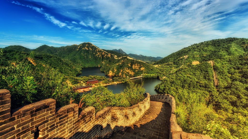
Photo by Johannes Plenio on Unsplash
Accommodation
Visitors have a variety of lodging alternatives along the Jinshanling Great Wall, including guesthouses and small hotels.
These lodgings provide hotel-style lodging in Jinshanling village, although with a more modest layout. The rooms provide hot water, air conditioning, and TVs (however, some rooms could not have TVs).
The rooms typically come with two separate beds. If you’re visiting with a handful of friends or kids, staying at one of these guesthouses will allow you to discover what living with a family is like.
When organizing your trip to the Jinshanling Great Wall, look at these surrounding attractions and reserve lodging in advance to guarantee a relaxing and pleasurable stay.
Food and Water
Bring at least two water bottles for four to five hours of hiking. Carrying nuts and raisins are also suitable for quick meals to keep your energy levels up.
For hikers, breakfast is a meal you should not skip because it offers the energy required to begin the walk. Before starting the hike, hikers should eat a nutritious breakfast at their lodging facility, including proteins, carbohydrates, and nutritious fats and oils. Breakfast suggestions for hikers include whole-grain bread, scrambled eggs, and oatmeal.
Lunch is also essential for hikers since it gives them the energy they need to keep going. After the hike, you can eat a Chinese lunch of fried chicken, pork, vegetables, and rice close to Jinshanling.
For hikers, dinner is essential since it gives them the energy they need to recover from their day’s journey. Hikers should not forget to pack protein-rich foods, carbohydrates, and nutritious fats for their evening meals. For supper, hikers are advised to choose among pasta, rice, and beans.
Snacks are essential for hikers since they give them rapid energy boosts that help them stay energized the entire time. Hikers are advised to include snacks such as nuts, candy bars, and raisins.
Since water keeps the human body hydrated and refreshed throughout the trek, it is the most important liquid beverage for hikers. Carrying enough water to last the duration of the climb is advised for hikers. Sports and electrolyte beverages are also advised to replace lost energy and electrolytes.
Challenges When Hiking the Jinshanling section of The Great Wall of China
The rough terrain is one challenge of hiking the Jinshanling section of the Great Wall of China. It’s crucial to wear adequate footwear and clothing and to descend gently to prevent any injury because the terrain is rough and includes loose pebbles and sand that can be slippery. If you routinely work out, you shouldn’t experience any problems with this trail. If you don’t exercise frequently, you can have leg stiffness and sore muscles for a maximum of two days following the hike.
Tips to know when hiking the Jinshanling section of The Great Wall of China
- Bring water and food: A modest bag filled with snacks and enough water for the lengthy trek will be helpful. Several merchants at each towering structure are hawking food and water at higher rates at the height of the season.
- Pick an appropriate route: The hiking may be taxing because of the frequent uphill and downhill hikes. You are not advised to hike for an extended period unless everyone in your group is physically fit. Pick the area that best suits your needs regarding time, physical condition, and points of interest.
- Most towers in the unrestored area are in danger of collapsing, making passage through them hazardous. Look for the paths that lead around the tower and return you to the Wall.
- Be appropriately dressed: Wear thick clothing and a fluffy coat to protect yourself from the chilly wind at the top if you plan to trek the Jinshanling Great Wall in the winter. You must protect yourself from the harsh sunshine in the summer by wearing a hat, sunglasses, and sunblock. Always be sure to put on a pair of comfy hiking shoes.
- After the hike, remember to stretch to ease the pain in your legs.
Potential Dangers
- Loose stones and debris: As you climb the Jinshanling section of the Great China Wall, you may encounter loose stones, and if you’re not careful, you could slip and hurt your leg.
- Dry region: The region around the Jinshanling section can be arid. You may quickly become thirsty and dehydrated. Having water by your side can always help avert this problem.
- Extreme weather conditions: Sometimes, the weather condition in Jinshanling can be severe, even when it shouldn’t be. Proper clothing can help solve this danger.
- Limited Facilities: Some sections of the Great Wall, particularly the more remote or less touristy areas, may have limited facilities such as restrooms, food stalls, or emergency services. It’s important to carry enough water, snacks, and any necessary medications. Additionally, having a map or a guidebook can be helpful in navigating the area.
Conclusion
You can fully immerse in history, take in stunning scenery, and partake in outdoor activities by visiting Jinshanling Great Wall. Jinshanling offers a distinctive and unforgettable experience, regardless of whether you walk, camp, or freely explore the region.
You may make the best possible use of your visit to this famous portion of the Great Wall of China with careful planning and consideration of the abovementioned suggestions.
Journeying down the Dragon’s Back, Hong Kong
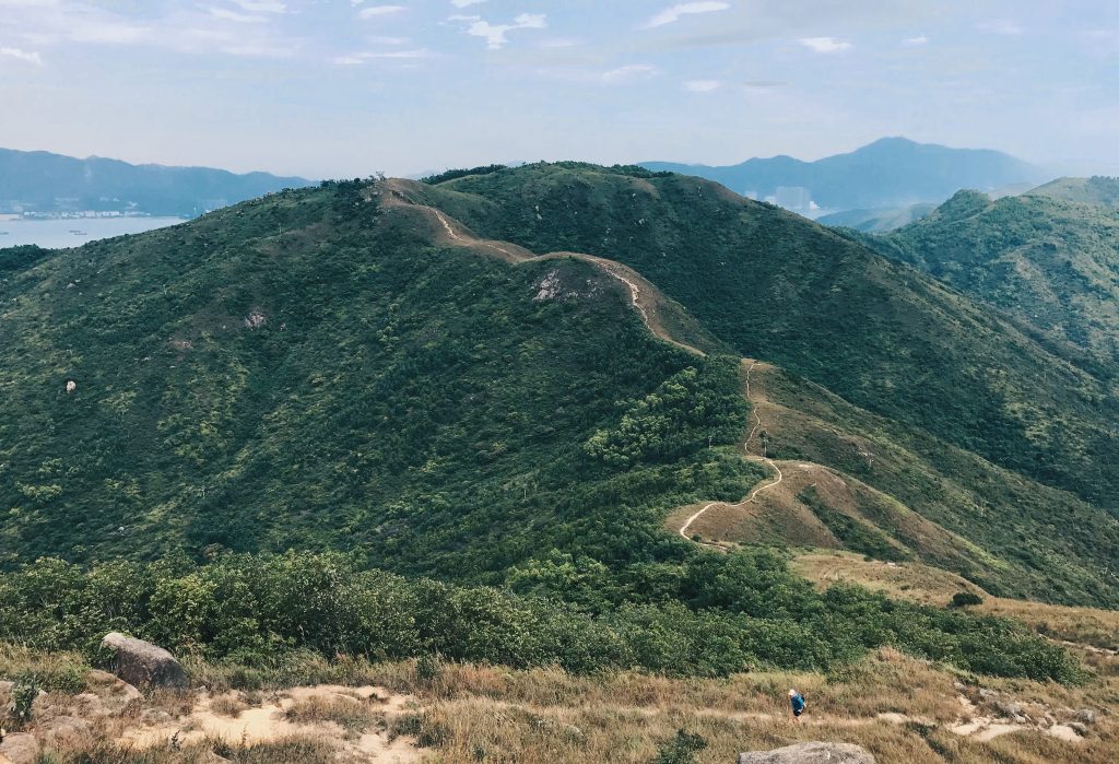
Photo by Photo by L_e C_y
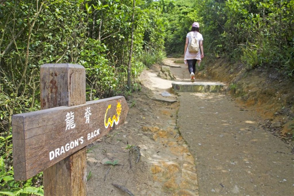
The mythical Dragon Back is located in the eastern part of Hong Kong Island, which has tempted countless travelers and locals. Everyone testifies to its beauty and splendor. Dragon’s Back is one of the well-known hiking paths in Hong Kong and even in Asia.
The pleasant walk around the southern tip of Hong Kong Island offers an unobstructed view of the city and sea to the sky. Dragon’s Back is simple to travel on your own, thanks to easy access and a well-marked track.
Whether you prefer hiking alone or with a group, Dragons Back is definitely for you as it is easy to hike, and it takes less than five hours to hike it from start to finish depending on your speed. Those who prefer hiking with a company and wish to learn more about the trail and Hiking in Hong Kong can go on a guided hike.
Brief History of Dragon’s Back
Dragon Back can be traced back to the ancient paths and trails the locals have used for centuries. These routes connected different communities on Hong Kong Island and were frequently created for trade, daily life, and communication.
The Hong Kong Trail Stage 8—officially known as the Dragon Back Trail—became well-known in the early 2000s as one of the area’s most well-known and iconic hiking paths. The walk, which is 8.5 kilometers (5.3 miles) long and winds through the park’s undulating slope, provides spectacular panoramic views of both sides of Hong Kong Island, including the city skyline on one side and the unspoiled coastline on the other.
As Hong Kong became more urbanized, a growing passion for outdoor recreation and natural exploration developed. The local population started to re-discover the old trails and routes in the 1980s and 1990s, which sparked a resurgence in Hiking and trail running.
The popularity of Hong Kong’s hiking routes, including Dragon Back, has made environmental awareness and conservation more of a priority. The trail’s natural beauty is preserved, and good outdoor behavior is encouraged among trail users. Beyond its recreational and sporting significance, Dragon Back is significant culturally as a representation of Hong Kong’s peaceful cohabitation of urban growth and natural beauty. It links to the area’s past, providing a window into the past while embracing the spirit of exploration and adventure.
Description of the Sight
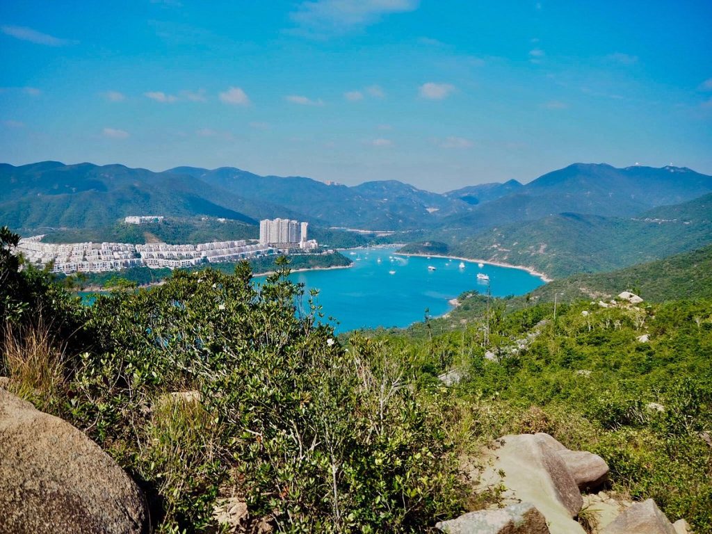
You may enjoy breathtaking panoramic views from the route on both sides of Hong Kong Island. You’ll see the lively cityscape with recognizable buildings and busy streets on one side, which contrasts sharply with the tranquility of the trail. The South China Sea’s emerald seas meet the coastline on the opposite side, providing a tranquil and beautiful scene.
Signs point the way to the Dragon’s Back | Photo by Hong Kong Tourism Board
When climbing Shek O Peak, you’ll receive a wide-ranging view encompassing the surrounding regions. The expansive perspective lets you take in Hong Kong’s natural beauty as you see the lush hills, rocky shorelines, and far-off islands dotting the water.
The trail offers a welcome respite from the bustle of the city as it winds through luxuriant greenery and thick vegetation. You will be completely enveloped in the tranquility of the natural environment as you walk among towering bamboo groves, native trees, and bright wildflowers.
The sparkling sands and calm seas can be seen as you go down to Shek O Beach. A fantastic place to rest and take in the seaside atmosphere, this picturesque seashore contrasts the rough landscape you’ve traveled through.
The exposed ridges that the Dragon’s Back trail follows give you the impression of walking above the earth. These open areas allow you to experience the calm sea wind and provide unimpeded views extending as far as the eye can see.
You might encounter artifacts from the trail’s past, such as aged stone markings or conventional walkways. These historical cues remind us of the trail’s importance in bridging communities and preserving a connection to Hong Kong’s past.
Ways to Get There
Air
The leading international entry point for the city is Hong Kong International Airport (HKG), where you would need to fly. You can then travel to Dragon’s Back from the airport using various means of transportation because it is on Chek Lap Kok Island.
The Mass Transit Railway
MTR, Hong Kong’s most well-known public transportation system, can serve you when you visit Hong Kong to hike the Dragon Back. Take the MTR to Shau Kei Wan Station (Island Line) to reach this destination. You can then take a taxi or a public bus to the trailhead.
Public Bus
Numerous public buses run between Hong Kong Island locations and Dragon’s Back trailhead; they are dependable and affordable. From Shau Kei Wan Bus Terminus, take bus number 9 or 9A to Shek O Road (To Tei Wan), where the trailhead is located. Alternatively, you can travel to To Tei Wan by taking bus number 309 from Quarry Bay MTR Station or Chai Wan MTR Station.
Rental cars and taxis
Rental cars and Taxis are a practical choice for a direct and pleasant commute. In Hong Kong, cabs are simple to come by, and you can ask the driver to take you to the To Tei Wan trailhead for the Dragon’s Back hike.
Guided Tours
if you’re looking for a more structured experience, many local tour organizations provide guided hikes to Dragon’s Back. While the Dragon Back isn’t difficult to hike, you can still consider Guided tours since they give a pleasant experience and provide group vehicles that will take you throughout the journey. These tours frequently include transportation, a guide, and perhaps even more activities.
Details on hiking The Basho Waferer
When to Go: Weather and Season
The most significant times to visit Hong Kong are in the winter and spring when the weather is pleasant and primarily dry when trekking is most enjoyable. The hike is enjoyable because of the cool, comfortable daytime temperatures rather than the oppressive summer heat. Packaging a light jacket or layers is a good idea because the evenings can turn chilly.
Wildflowers of all hues bloom on the hillsides as the weather begins to warm up in spring. March and April can be pretty pleasant, but the humidity levels rise as May approaches, making the hike a little more challenging.
Hikers should be ready for sudden weather changes, though it’s crucial to remember that the weather on Hong Kong Island can be unpredictable. Before your excursion, check the weather and be ready for unforeseen events; this will assist you in enjoying your hike more safely and comfortably.
Accommodation
Shek O is an excellent option if you’re looking for a beachfront getaway where you can wake up to the sound of lapping waves. Shek O is a charming community with a relaxed atmosphere, with several boutique hotels and guesthouses with quick access to the trail. Imagine leaving your lodging and starting your hike in a matter of minutes. Shek O is a great place to start your adventure because it is convenient.
Consider staying in one of the beautiful guesthouses that dot the area for a more personal experience. These lodgings provide a homey setting, attentive service, and a window into the way of life in the area. It’s a chance to become involved in the neighborhood, enjoy regional cuisine, and converse with welcoming hosts who can provide insights.
Those looking for a home away from home can look through the Airbnb listings in Shek O and the surrounding area. To accommodate your group size and interests, Airbnb offers many possibilities, from adorable apartments to roomy mansions. Choose a location with a balcony to enjoy the lovely views or a quaint hideaway to unwind and recharge.
Affordable hostels can be found nearby in places like Shau Kei Wan if you’re traveling alone or on a tight budget. Although not exactly on the beach, these hostels offer a handy place to start your hike and a lively environment to meet other tourists.
Food and Water
Based on the anticipated length of your trek, pack enough food and drink before you go. Consider elements like the climate, your hydration requirements, and the presence of refill locations. There may not be many water sources along the Dragon’s Back route. However, there are water fountains and restrooms at the Shek O Road gate, where you may fill your water bottles. It is advisable to have a portable water filter or purification tablets on hand so that, in an emergency, you can use natural water sources like streams. Remember that access to safe drinking water is essential to maintaining your health and avoiding dehydration.
In addition, Basic amenities like benches and rest spots can be found along the trail. These locations are excellent for quick breaks and eating snacks or small meals. Bring non-perishable, energizing items like trail mix, granola bars, dried fruit, and almonds. These snacks provide an immediate energy boost without adding much weight to your pack.
You will eventually arrive in Shek O Village near the trail’s end. Local restaurants and convenience stores where you can buy food and drinks are located here. Before finishing the hike or continuing to explore the area, it’s the ideal time to refuel.
However, Portion control is crucial to maintain energy levels while avoiding overeating. Uncomfortability and sluggishness can result from excessive intake. Choose modest, regular snacks over large meals to stabilize your energy level during the trip.
Tips to know when hiking Dragon’s Back
- Hiking Permit: Although the Dragon’s Back trail often does not require a hiking permit, checking the most recent rules before your hike is a good idea, as regulations sometimes change.
- Begin Early: Start your hike early in the morning to escape the midday heat, take advantage of the peace as there won’t be many people, and give yourself enough time to complete the trail. You can always start early and end early to obtain enough sleep at your lodge.
- Protect yourself from the sun’s rays by wearing a wide-brimmed hat, sunscreen, and sunglasses. The exposed portions of the trail put you at risk for sunburn and glare.
- Mosquitoes and Insects may be present depending on the season. To prevent itchy bites and protect yourself, ensure you have a protective net and always keep an efficient bug repellent.
Potential Dangers
Steep Terrain
The Dragon’s Backtrack has severe ascents and descents. Uneven ground, loose rocks, and steep parts increase the slips, trips, and falls risk. It’s essential to move carefully and wear proper, traction-enhancing footwear. Choose sturdy hiking footwear that offers good traction and ankle support. To prevent slips and injuries on the uneven terrain of the trail, you must wear strong footwear.
Wildlife
Although dangerous wildlife interactions are uncommon, you can encounter insects, snakes, or other species. Take care not to disturb any wildlife. Learn about the local wildlife and how to respond if you come into contact with it.
Conditions of Crowding
On weekends and holidays, the Dragon’s Back trail can become crowded. Crowds might hinder your progress and harm your experience. To avoid the busiest hours, think about trekking during the workweek or in the early morning.
Exposure and restricted walkways
Some sections of the trail include exposed ridges and restricted walkways. Although these areas have beautiful views, they can also be frightening, especially for people afraid of heights. Be cautious and abstain from taking unwarranted chances.
Limited Resources
There aren’t many amenities along the trail, such as garbage cans and restrooms. Plan your bathroom breaks and pack out all your rubbish. Bring along necessities like Kleenex, hand sanitizer, and trash bags.
While there are certain dangers to look out for, it is still possible to enjoy the beautiful scenery and
Conclusion
The numerous advantages of hiking Dragon’s Back make it a remarkable outdoor activity. Its breathtaking natural beauty and expansive views offer a visual feast and a chance for renewal and reconnection with nature. Beyond its attractive aesthetics, Dragon’s Back has health benefits, enhancing muscular strength, cardiovascular fitness, and general fitness.
The climb also promotes mental health since it provides a meditative break from the stresses of daily life, promoting reflection and mental clarity.
Additionally, the social aspect of hiking Dragon’s Back fosters relationships and possibilities for shared experiences, making it an excellent activity for groups of friends, families, and single travelers. In the end, the significance of hiking Dragon’s Back encompasses holistic benefits that go well beyond its picturesque routes.
Remember that Hiking has its challenges, but the advantages are much more than the challenges, take care to apply the tips mentioned earlier, and your hike will not only be eventful and enjoyable, but it will also be without harm.
Unveiling the beauty of the Dingle Way, Ireland
Photo by Nil Nedel on Unsplash
The Dingle Way, tucked away in Ireland’s wild and beautiful landscapes, is a monument to the island’s extraordinary beauty and rich cultural history. The Dingle Peninsula, a location famed for its beautiful coastal vistas, rolling green hills, and attractive villages, is home to this alluring long-distance Trail.
The Dingle Way, one of Ireland’s most well-known walking trails, provides explorers and nature lovers an unrivaled opportunity to experience the Emerald Isle’s enchantment fully. The Dingle Way promises a fantastic journey encapsulating Ireland’s culture. If you are looking for a soul-stirring trek through historic sites, an insight into Gaelic traditions, or simply a chance to lose yourself in the peace of unspoiled nature, you should consider the Dingle Way, Ireland.
It could be that you are far from Ireland or need to know more about dingle ways to get there. Let us consider all that you need to know before setting out to explore this beauty.
Brief History
The Dingle Way’s history may be traced back through centuries of human interaction with the alluring landscapes of the Dingle Peninsula. It is a tale that is intertwined with the history of Ireland. The Trail’s precise beginnings are still obscure in the mists of time, and its historical significance is intricately tied to the area’s cultural heritage and the footsteps of previous generations.
The Dingle Way progressively became a recognized trail as long-distance hiking became more common in the contemporary era, providing a route for tourists and residents to experience the peninsula’s natural marvels and historical relics. In the latter half of the 20th century, as initiatives to protect and highlight the area’s distinctive beauty gained traction, the Dingle Way became a known walking route.
The Dingle Way passes by some of Ireland’s most impressive archaeological sites. The most noticeable buildings along the way are standing stones, ogham stones, and several beehive huts.
The Dingle Way is a living example of how nature, culture, and human activity coexist today. Routes meander past antiquated ruin sites, past artifacts from a bygone era, and next to bustling towns that yet carry the sounds of ancient generations. The development of the Trai reflects the more general trend of eco-tourism and outdoor adventure, demonstrating the enduring relationship between people and their environment.
On the Dingle Way, hikers and walkers follow in the footsteps of history as they follow a path that captures the best of Ireland’s past and present. Trail’s continued appeal demonstrates its capacity to teleport modern adventurers into a world where time-honored customs and the grandeur of nature collide, allowing everyone who travels along it to participate in its always-changing story.
Description of the Sight
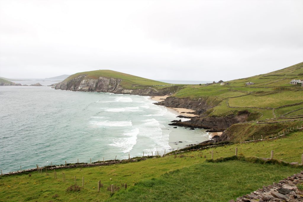
Photo by Hanna May on Unsplash
A sensory symphony is presented with each stride along The Dingle Way, a mesmerizing tapestry woven into the fabric of Ireland’s southwest coast. An expedition unlike any other is promised by this 179-kilometer Trail, a beautiful fusion of nature’s most significant components and human history.
One is immediately intrigued by the striking contrasts the Dingle Way displays when looking at it. The rough shoreline, which the Atlantic Ocean’s foamy waves kiss, serves as a sturdy sentinel against the ebb and flow of time. Stone cliffs stand boldly, their faces worn by ages of wind and sea, while secret coves beckon moments of reflection.
Inland, the scenery changes into a lush paradise. The view of rolling hills covered in the distinctively green vegetation of Ireland seems to go on forever. Walls that are hundreds of years old, a reminder of the labor and legacy of earlier generations, adorn these undulating plains.
As the trail winds through adorable communities, more of its charm is revealed. With thatched roofs and beautiful flowers, decorations radiate a simple charm that calls to mind earlier times. Village entices visitors to stop and take part in the conviviality with the warmth of its taverns and the friendliness of its residents.
But the constantly changing interplay of light makes the Dingle Way a magical sight. A spell is created by the sun’s gentle touch, transforming the scenery from delicate pastels to vibrant, blazing hues, drawing wanderers further into its embrace. Tribute to the breathtaking splendor of Ireland’s wild heart, the Dingle Way creates a lasting impression with each passing second.
Ways to Get There
Travel by Air
Flying into Ireland is the most frequent method of accessing the Dingle Way. Airport (Farranfore) and Shannon Airport are the closest international airports. Closer to the Dingle Peninsula, Kerry Airport is incredibly convenient. Getting to the trailhead from the airport is very easy.
Car Rentage
Renting a car gives you the freedom to get to the trailhead and explore the Dingle Peninsula. Airports and cities in Ireland have many automobile rental companies. It gives you access to various stretches of the Dingle Way and lets you explore the charming communities along the way.
Public transportation:
Major Irish cities have buses and trains that travel to locations close to the Dingle Peninsula. You can go to Tralee or Killarney by train or bus, where you can change to a local bus that will bring you closer to the Dingle Way.
Guided Tours
A guided tour is an additional choice, particularly if you want a hassle-free excursion. Tour companies provide planned excursions to the Dingle Way that may include lodging, transportation, and guided treks.
Ferry:
You might consider taking a ferry to get to the Dingle Peninsula while touring other regions of Ireland. Different and beautiful route to your destination is made possible by the ferries between numerous coastal towns and islands.
Details on hiking Tour du Mont Blanc
When to Go: Weather and Season
The spring, which includes the months of April to June, is undoubtedly the ideal time to climb the Dingle Way. The rugged terrain of the Dingle Peninsula comes to life during this time, providing a colorful backdrop for your hiking journey.
Hikers on the Dingle Way can benefit from several benefits in the spring. Hiking conditions are favorable due to the milder weather, temperate temperatures, and longer daylight hours. Every step you take will be a visual treat as the landscape is flooded with blossoming wildflowers, creating a kaleidoscope of hues to your journey.
The trails are typically less busy than the busiest summer months, creating a more serene and immersive experience. Along the trip, you’ll have the chance to get up close and personal with the breathtaking coastal views, historic archaeological sites, and sleepy villages.
Although spring weather can be erratic, difficulties can be minimized with careful planning and the right equipment. In conclusion, picking spring for your Dingle Way hike entails setting off on an enthralling trip amid the majesty of nature and enjoying the ideal harmony of weather, scenery, and isolation.
Accommodation

Numerous lodging alternatives are available to greet weary travelers along the intriguing Dingle Way, ensuring a relaxing and delightful journey through the magnificent surroundings of the Dingle Peninsula. The path offers various locations to rest and refuel, whether looking for traditional Irish cottages’ rustic beauty or warm inns’ contemporary conveniences.
The Dingle Way is known for its charming bed & breakfasts, which provide a warm and individualized touch. Family-run hotels offer cozy rooms frequently decorated with flowers and a filling Irish breakfast to start your day. With this choice, you can interact with people and learn about the local way of life.
Farm stays offer a unique chance to engage with the land and its keepers for those seeking a more in-depth experience. They can participate in agricultural activities, savor farm-to-table cuisine, and take in the peace of country living.
Charming guesthouses and inns with cutting-edge conveniences and classic architecture may be found in the villages and towns that dot the Trail. Lodgings provide a variety of room kinds to accommodate various spending limits and tastes.
Hostels are a practical choice for travelers on a tight budget and backpackers because they frequently provide common areas and dormitories. These are fantastic locations to meet and chat with other hikers.
Camping is another choice for the more daring as you cross the breathtaking terrain. The Dingle Way has designated campsites to set up your tent and get close to nature.
It’s vital to remember that making reservations in advance, especially during the busiest summer months, is a good idea to guarantee your stay. Hikers, whether seeking authenticity, comfort, or cost, can find a perfect spot to rest before beginning the excellent Dingle Way treks, thanks to the range of hotel alternatives.
Food and Water
The eating options along the path feature traditional Irish cuisine and contemporary gastronomy, reflecting the Dingle Peninsula’s rich culinary past.
Hearty meals and regional specialties can be enjoyed at the hospitable restaurants scattered throughout the charming villages and towns along the route. Locations are frequently more than just restaurants; they are also centers of culture and community where visitors may interact with neighbors and other hikers while satiating their appetites.
Traditional Irish pubs offer a welcoming and friendly setting to eat traditional pub fare like fish and chips, substantial stews, and handcrafted pies. You may also choose from a fine array of regional beers, stouts, and whiskeys in many of these places to fully experience Ireland’s thriving pub scene.
While you can get most of what you need around the Trail, it is also important to travel with dry foods that you can keep and eat later. If you have never tried Irish foods, you should look forward to trying them. Still, you should also carry foods your body system is familiar with. Also, don’t forget water is an essential aspect of the hike, so carry a lot of water and a bottle to refill as you hike.
Tips to know when hiking
- Carry enough cash for shopping because some smaller settlements along the route may not have many card payment alternatives.
- Know the local emergency numbers and the closest medical facilities in an emergency.
- Remember to go with your camera so you can take pictures for memory
- When getting food and water, respect regional customs and traditions. Request authorization before entering private property to use water supplies.
- Use Leave No Trace principles, pack out any waste, stay on designated trails, and do not harm plants or animals to reduce your environmental influence.
- Observe Your Pace, and There is always another day to trek the Trail, so be careful not to overdo it. Begin at a comfortable pace and stop when necessary.
Potential Dangers
1. Cliff Edges: Along the shoreline, the Trail occasionally skirts the edge of a cliff. Cautious and keep away from edges that may be unstable. The Dingle Way offers beautiful views along cliffs, but these areas can also present serious risks. It may be challenging to navigate narrow or steep paths. A slip-up or loss of balance could cause catastrophic accidents or falls. Hikers should proceed with caution, keep on pathways that have been marked, and stay away from the margins..
2. Remote and Isolated Locations: The Dingle Way travels through remote, thinly populated locales, challenging reaching help in an emergency. Communication can be difficult when cell phone coverage is patchy or nonexistent. When there are injuries, getting immediate medical attention may take longer. Hiking in a group or letting someone know your desired path can increase security.
3. Wildlife Encounters: Although coming into contact with animals while hiking might be exciting, treating them with care is crucial. Wildlife, including livestock, birds, and possibly more giant creatures like deer, are drawn to the Dingle Way by its natural beauty. Hikers should keep their distance from any animals they come across and refrain from startling or provoking them. There’s a chance of entering domesticated animals in some areas, such as sheep or cattle, which can be territorially aggressive. Maintaining your composure and gradually backing away to avoid unnecessary conflicts is essential.
Conclusion
The Dingle Way is particularly enjoyable since it can accommodate a variety of tastes and skills. Trail caters to everyone, guaranteeing a rewarding excursion, whether you are an experienced hiker looking for a challenge or a casual walker wanting peaceful strolls. The welcoming nature of the local communities along the way adds to the journey’s richness by revealing the area’s rich cultural past and encouraging a sense of community.
After finishing the Dingle Way, the sense of achievement is immense because every step reveals breathtaking sights and profoundly peaceful moments. Landscape and human interaction on the Trail combine to create a tapestry of memories that stay in the mind long after the journey.
Ultimately, the Dingle Way is more than simply a hike; it’s an alluring journey that encourages visitors to appreciate the wonders of nature while creating closer ties to Ireland’s soul-stirring landscapes and the kind-hearted people who call this country home. Dingle Way is a living example of the happiness and pleasure of embracing nature’s wonders, whether seeking solitude, friendship, or a chance to revitalize your spirit.
Exploring Northern Culture and Aesthetics – Basho Wayfarer, Japan
The Basho Wayfarer Trail takes visitors on an enthralling journey that perfectly blends the past and present and invites them to uncover the timeless essence of the natural world and the human spirit. A unique combination of intellectual discovery and unmatched beauty may be found on the Basho Wayfarer Trail, an exquisite landscape trip that influenced the famed Japanese poet Matsuo Basho.
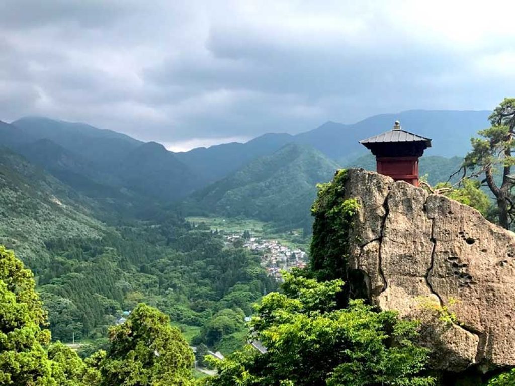
Following this route, visitors can walk in the haiku master’s footsteps from the 17th century and experience the tranquil settings and rich cultural heritage that shaped his most famous works. This article discusses the essential things you need to know about walking the Basho area to get the most out of your trip and how to be safe during the hike.
Brief History of Basho Wayfarer
The Basho Wayfarer Trail is a modern homage to the writings of Matsuo Basho, a well-known Japanese poet of the Edo Period (17th century). In his well-known travelogue, “Narrow Road to the Deep North” (Oku no Hosomichi), Basho experienced and described the landscape that the road meanders through.
In the latter half of the 17th century, the renowned haiku poet Matsuo Basho embarked on his epic journey. His voyage across Japan’s northern regions is chronicled in the book “Narrow Road to the Deep North,” which also includes his most profound observations and the beauty of the natural environment. Basho’s colorful poetry, which he wrote while on the road, had a lasting influence on Japanese literature and is still read widely today, and it still motivates many to hike or walk his path.
While walking this trail, hikers engage with Basho’s literary journey and appreciate his continuing influence and the enduring beauty of the places he visited. Modern travelers can appreciate Basho’s attitude of inquiry and reflection through this immersive experience, creating a solid connection across generations and countries.
Description of the Sight
The Basho Wayfarer trail in Japan is more than a hike; it’s an immersive journey through nature and time that follows the poet Matsuo Basho’s famous haiku. This walk takes hikers past the settings that inspired some of his most famous lyrics, enabling them to feel a solid connection to Japan’s natural beauty and the spirit of artistic reflection.
You’ll come across tranquil temple gardens, historic stone walkways, and stunning views as you travel the route that Basho once took. These sights have mainly not altered since his day. It is more than just a physical challenge; it’s a journey into the heart of Japan’s cultural and natural legacy, where each step becomes a stanza in the evolving poem of your own life-changing experience.
The Basho Wayfarer Trail offers a dynamic fusion of literary appreciation and outdoor experience as a link between the past and the present. As they travel this trail, hikers interact with Basho’s literary journey, developing an appreciation for his ongoing influence and the enduring beauty of the regions he traveled through. Through this immersive experience, modern tourists can enjoy Basho’s spirit of discovery and introspection, forging a potent bond across generations and cultures.
You can retrace the poet’s tracks with the six-day Self-Guided Basho Wayfarer, which starts in Sendai and ends at Yamadera. Each day, the traveler can walk for five to 14km (three to four hours), following detailed instructions and an itinerary that suits his energy level. The route is gently undulating, but there are some forest trails and steep stone steps to conquer.
Japan is home to several historic paths that link its cities and temples. The route traveled by the poet Matsuo Basho more than 300 years ago is replicated in this self-guided tour.
Ways to Get There
1. Train: One of Japan’s most significant ways to travel between cities and regions is by train, thanks to the country’s vast and effective rail system. You can travel great distances fast and comfortably thanks to Shinkansen’s famed speed and connectivity.
2. Local Buses: Local buses are a dependable form of transportation in regions that aren’t reachable by train. The regular buses run from Sendai to your accommodation and even the trail. They link small towns, tourist destinations, and rural areas.
3. Walking and trekking: Walking and trekking through picturesque locations is a terrific opportunity to connect with the terrain and fully immerse yourself in nature, which will help you experience the spirit of Basho’s voyage. All around Japan, there are numerous ancient hiking and pilgrimage pathways.
4. Renting a car: Although less popular than public transportation due to urban congestion, renting a car can help travel through remote areas and other places where public transportation is not as readily available. By renting a car, you don’t have to worry about locations. The driver can easily navigate the area and even show you some places.
Details on hiking The Basho Waferer Trail
When to Go: Weather and Season
The weather may significantly impact the ambiance and mood of the places you visit. For instance, going to a calm temple garden amid a drizzle or strolling through a forest amid a light snowfall can arouse a distinct sensation of serenity and reflection, similar to the feelings of Basho’s poetry.
Warmer and muggier weather is introduced throughout the summer, from June to August. While this time of year offers spectacular views and lush vegetation, hikers should be ready for hot weather and sporadic showers. Sun protection and proper hydration are essential.
Hiking is most popular throughout the fall, which lasts from September to November. The crisp air and gorgeous fall foliage transform the paths into a painter’s pallet of reds, oranges, and yellows. Hiking is enjoyable due to the milder temperatures, and the stunning environment invites visitors to appreciate Sendai’s abundant natural beauty fully.
Sendai is covered in snow from December to February, making for beautiful, rugged hiking terrain. Snow-covered paths and frozen landscapes are attractive, but it takes suitable winter clothing and prudence to travel safely.
It is advisable to visit Sendai for the hike from mid-may to early November; the climate is often milder and more suited to outdoor activities during this time. Although it is warmer from June to August, it is not as oppressively hot and humid as it is during the height of summer. Hiking is even more comfortable in the spring and fall (May, September, and October) when the weather is almost perfect.
Accommodation
1. Ryokan: A stay at a ryokan (traditional Japanese inn) can be a lovely serene, and culturally rewarding experience. Ryokans are lodging establishments with traditional tatami-mat rooms, futon mattresses, and frequent meals served in the room. This option offers a glimpse into Japanese hospitality and way of life. Not only will you enjoy the Japanese culture when you hike, but you can also be immersed in it when you rest.
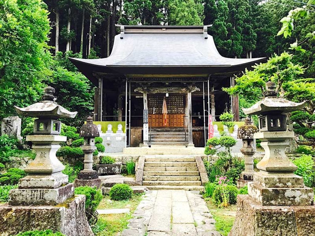
2. Minshuku: These family-run inns provide a more specialized experience. They often operate in rural areas and serve home-cooked meals. This decision might reveal information about local traditions and culture. Most of these Inns are available near the Basho Wayfarer starting points, making it even better.
3. Temple dormitories (Shukubo): Several temples offer lodging to travelers on religious or historical pilgrimages. One might have a unique spiritual experience by staying in a temple, such as participating in morning prayers and meditation.
4. Hotels: There are hotels in more urban locations, ranging in style and cost. Remember that hotel decor and ambiance might vary, so think about picking accommodations that go with the theme of your trip. When choosing hotels, pay attention to how easy it will be to get to the trail from your hotel.
Food and Water
1. Always keep a reusable water bottle with you: This is crucial. To stay hydrated, often refill it at water fountains, convenience stores, and rest stops. Hiking can be pretty tasking, so you will need water. Look for water sources like rivers, streams, and public faucets throughout your journey. You may be able to replenish your water bottle at these locations and carry less weight overall.
2. Bring Snacks: Trail mix, energy bars, dried fruit, and almonds are a few compact, transportable snacks high in energy. These provide fast meals during breaks. You will need them.
3. Local Markets and Shops: In many rural areas, local markets and shops sell fresh fruits, vegetables, and other delicacies. Include these places in your itinerary. You can also get Ready-to-Eat Foods In some of these places. Ensure to try out Japanese foods that you never had while keeping your stomach in check.
4. Cooking Equipment: If you intend to camp or stay in a place with a kitchen, think about bringing light cooking equipment: This enables you to make straightforward dishes like soup or quick noodles. Also, Learn about easy-to-transport, unprepared local specialties. These can enhance the cultural flavor of your travels.
Challenges along the Basho Wayfarer
1. Trail Conditions: Uneven terrain, rocky paths, tree roots, and loose gravel can make hiking more physically demanding and require careful footing.
2. Navigation: Trails may be poorly marked or have multiple intersections, leading to confusion and the possibility of taking wrong turns. It would be best if you carried physical maps, GPS units, and smartphone apps for navigation
3. Blisters and Foot Discomfort: Ill-fitting footwear or excessive moisture can lead to blisters and discomfort, impacting the overall hiking experience.
4. Restroom Facilities: Access to restroom facilities may be limited or unavailable: this could require you to plan accordingly.
5. Limited Cell Signal: Remote areas might have weak or no cell reception, limiting communication and emergency assistance options.
Helpful Tips
- A fully charged smartphone with an emergency contact list, a first aid kit, a whistle, a torch, a multi-tool, and other items should all be carried. Include any personal medical devices and necessary medications.
- Share Your Itinerary: Let someone you trust know where you’re going and when you intend to arrive. Thanks to this, someone will know your location in an emergency.
- Remember to go with your camera so you can take pictures of cute things and always go back to them.
- Cultural Sensitivity: When getting food and water, respect regional customs and traditions. Request authorization before entering private property to use water supplies.
- Communication: Information access may be restricted in rural places. Inquire locally about the availability of food and water along your trip.
Potential Dangers
- For modern visitors, exploring unfamiliar regions contains appeal and difficulties, as celebrated in Basho’s literary journey. Even the most daring travelers can be tested by dangerous roads, high mountains, and dense forests, even as the beauty of nature beckons. The hazards are amplified by unpredictable weather, hot summers, and chilly winters, which affect physical health and travel plans.
- Today’s travelers may experience solitude and sparse amenities in far-off places, aggravating possible risks. Accidents and illnesses are made more dangerous by poor communication and restricted access to healthcare. Interactions may be hampered by linguistic and cultural obstacles, which can also hinder aid. Traveling in a foreign country can lead to misunderstandings or challenges in communication. Hikers should familiarize themselves with local customs and basic Japanese phrases.
- There is also the danger of encountering wildlife, such as boars or giant flying squirrels. It’s vital to minimize attracting animals by properly storing food and waste. Modern travelers uphold the essence of Basho’s journey by embracing nature’s allure while respecting its unpredictability.
Conclusion
A magical voyage into nature’s embrace, where the spirit of renowned poet Matsuo Basho reverberates, can be had by hiking the Basho Wayfarer trail. You can discover peace in quiet temple grounds, marvel at flowering cherry blossoms, and see landscapes painted in the tones of his lyrics as you follow the path he once walked.
Each step reveals a sensory symphony, including the touch of old stones, the whisper of leaves, and the aroma of wildflowers. Accept the difficulties—including arduous ascents and the whims of the weather—and learn to enjoy the benefits of isolation and introspection. Basho’s legacy flourishes amid challenging terrain, enticing you to appreciate the beauty of nature and create your lyrical trip.
As you plan your trip to Japan, Sendai to the BashoWayferer, keep in my mind that you might have certain limitations, but that should not hinder you from making the best use of your time and enjoying the hike to the fullest.
Armenia and the Silk Road: Tracing Ancient Trade Routes and Cultural Heritage.
Photo by Ivars Utinans on Unsplash
Learn the secrets of the Silk Road’s impact on this fascinating land as you experience beautiful panoramas, friendly natives, and a blend of the past and present. Historic routes wind through breathtaking scenery to create a cultural tapestry along the fabled Silk Road. Take a trip that combines the enduring appeal of hiking with the fascinating history of this Eurasian intersection.
You will feel the excitement of exploration as you travel across Armenia’s rough terrain, and you will also be retracing the routes of the traders, explorers, and pilgrims who once traveled the legendary Silk Road.
Let us explore the essential hiking routes in Armenia and look for historical echoes of the Silk Road, making memories that combine nature, history, and adventure in a fantastic journey. We will also consider helpful tips to make your tour more fulfilling and enjoyable.
Brief History of the Armenia and the Silk Road
Armenia has played a crucial role in the complex history of the Silk Road. For many years, this region has played a crucial role in allowing the interchange of products, ideas, and civilizations between Asia and Europe. The great civilizations of China and the Mediterranean were linked by the Silk Road, a network of prehistoric trade routes covering more than 6,000 kilometers.
Photo by Nare Gevorgyan on Unsplash
Armenia’s vital participation in this commerce web was secured by its advantageous position. Armenia developed as a vital stopping location, supporting thriving commercial hubs and bustling markets, as caravans laden with silk, spices, and precious metals traveled these routes.
Armenia influenced the Silk Road in many ways than just trade. Thanks to its diverse population and rich cultural heritage, the nation was a melting pot of languages, ideologies, and cultures. Travelers left cultural traces behind as they traversed its regions, enhancing Armenia’s unique tapestry.
The Silk Road did, however, have particular difficulties. Armenia’s fate was formed by the ebb and flow of various empires, including the Persian, Roman, Byzantine, and Ottoman. It experienced both prosperous and turbulent times, permanently altering the course of its history.
Hikers now use the same roads merchants and explorers formerly took as they traverse Armenia’s footpaths. The Silk Road’s echoes continue reverberating, constantly reminding Armenia’s important role in this momentous period of human history.
It is also important to note that the Silk Way is about 4000 miles, and there are few cities along the way; this means that it takes a lot of time to go from one end to the other end of the Silk way. The love of nature and the curiosity about history brings so many people to the silk way every year.
Description of the Sight
Discoverers will find the historic Garni Temple and its stunning environs nestled amid the rough embrace of the Armenian mountains. The Garni Temple is a gem that carries tourists through time, a monument to the continuing spirit of Armenia’s historical and architectural legacy.
Visitors are welcomed by a facade covered with elaborate carvings and ornate features that whisper tales of gods, goddesses, and legendary creatures as they approach the temple. A journey in and of itself, the enormous staircase leading to the temple provides panoramic views of the surroundings, including the symmetrical columns and massive arches that adorn the temple’s facade.
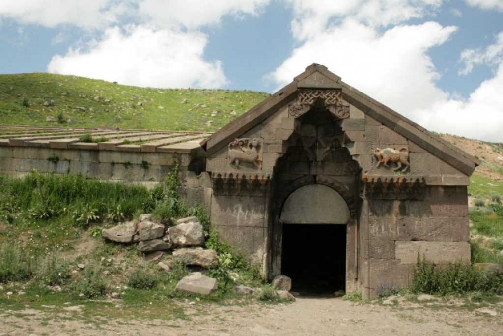
When one enters, a sensation of infinity embraces them. The central room, which previously served as a temple dedicated to the sun god Mihr, emanates a reverent and ethereal ambiance. The whispers of old rituals and ceremonies still seem to reverberate off the temple’s stone walls despite the passing of centuries.
Beyond the temple itself, the location has other attractions. Explore the ruins of an ancient royal palace and try to picture the life of the people who lived here in the past. The Azat River will then stream through the gorge below as you marvel at the harmony of nature and architecture.
More than just a sight, Garni Temple is a multifaceted experience that awakens the senses and sparks the imagination. It serves as a window into Armenia’s history, a prompt to consider the passage of time and a reminder of the unbreakable bonds that bind civilizations together over the ages. Visitors can’t help but feel a deep connection to the fabric of history, culture, and natural beauty as the sun reflects its golden hues across the ancient stones.
Ways to Get There
Airplane
Depending on your location, it might be appropriate to take a flight, especially if you are visiting Armenia from another country. Your plane will touch down at Yerevan’s Zvartnots International Airport (EVN). When you arrive, you can then use other forms of transportation to get to the Silk Way.
Private Vehicle
Using a private vehicle is the most adaptable mode of transportation. Driving in Armenia lets you explore the country’s roadways at your speed. Follow the M4 highway east from Yerevan, the country’s capital, and arrive at the temple’s entrance in about an hour. The excursion promises beautiful views and the chance to visit neighboring sights.
Public Transportation
From Yerevan’s Garegin Nzhdeh Square, take a bus or marshrutka (minibus) to experience local life. These affordable choices let you see a bit of daily life as you travel through towns and natural settings. Arrive at Garni Village, then stroll at your own pace to the temple.
Group Tours
Joining a guided tour will bring you to the depths of Garni’s history through the perspectives of skilled guides. Since so many tours include transportation, leaving Yerevan is hassle-free. As you journey with like-minded hikers, engage with the temple’s history.
Details on hiking Tour du Mont Blanc
When to Go: Weather and Season
The best time to hike Armenia and travel the Silk Road is probably in the spring, which makes the months of April through June the best time to embark on this thrilling journey.
As nature awakens from winter slumber, Armenia becomes a hiker’s paradise in the spring. The nice moderate weather makes for a great outdoor exploration environment, with temperatures ranging from cozy to warm. The vistas explode with color, with wildflowers covering the pathways and rich vegetation adorning the valleys and mountain slopes.
This time of year, hiking has a lot of benefits. You can quickly go around the area because the pathways are clear and accessible. Traveling through the lovely landscape, you’ll encounter historical landmarks like the Garni Temple and old Silk.
Hikers also have the chance to observe the local way of life up close during the spring. Traveling through rural areas, you’ll see locals tending to their orchards and farms, offering a fascinating cultural immersion.
Although spring is typically the finest time of year for hiking, it is still advisable to be prepared for changing weather, especially at higher elevations. Packaging the necessary gear and clothing layers can prepare you for unforeseen changes.
When you start your hiking trip in Armenia’s springtime splendor, you’ll experience the area’s unmatched beauty and learn about the Silk Road’s historical mysteries, all while taking advantage of the pleasant weather and breathtaking views that make for an unforgettable adventure.
Accommodation
Various lodging choices are available in Armenia and along the Silk Road to accommodate different tastes and price ranges. Armenia offers a variety of options for both urban adventurers and outdoor lovers. The capital, Yerevan, is home to many hotels, from opulent buildings with cutting-edge amenities to lovely boutique hotels with regional charm.
Hostels and guesthouses offer inexpensive options and promote interactions with other tourists. Cozy lodges and bed-and-breakfasts provide relaxing retreats in cities like Gyumri, Vanadzor, and Dilijan. Spa resorts in Jermuk offer relaxation after a day of exploring for a hint of indulgence.
Accommodations when traveling the Silk Road vary by region. Charming inns and guesthouses offer a warm welcome in Georgia and Iran. Modern hotels and boutique accommodations are available in Turkey in hotspots like Istanbul and ancient wonders like Cappadocia.
Food and Water
1. Local Cuisine: Every town along the Silk Road has a rich gastronomic history. Enjoy grilled pork, lavash (flatbread), and dolma (stuffed grape leaves) in Armenia. Enjoy Georgian khachapuri (cheese-filled bread), Iranian kebabs, and Chinese dumplings as you travel east. It is a good thing you will be here for a few weeks. It will make it possible to try all sorts of local delicacies
2. Street foods Enjoy the vibrant street food scenes and regional markets found along the route. These provide an opportunity to meet people and get a real taste of regional specialties. Choose stalls with a high turnover rate and use caution with hygiene.
3. Restaurants & Cafés: Along the Silk Road, cities and towns provide a range of dining establishments, from posh diners to inexpensive joints. Ask other travelers or locals for advice and research popular local attractions.
4. Bottled water: Even though tap water is typically safe in various nations, it is best to stick with it to prevent potential health risks. Please bring a reusable bottle and fill it with bottled water from reliable suppliers.
5. Food Safety: Be mindful of food cleanliness, particularly at markets and roadside stands. Ensure that freshly prepared food is served hot, that fruits and vegetables are thoroughly cleaned, and that dairy items have been pasteurized.
Tips to know when hiking the Silk way
- The vistas you travel through are magnificent. Follow the “Leave No Trace” guidelines to leave the smallest possible environmental footprint and protect the environment for future generations.
- Capture Memories, Journal, sketch, or take photos to record your adventure. These souvenirs will serve as enduring keepsakes of your life-changing journey.
- Seek seclusion and Connection. Strike a balance between times of seclusion and chances to interact with locals or other hikers. These exchanges enhance your comprehension of the areas you visit, which can present new perspectives.
- Pace yourself and take breaks as necessary to recharge, hydrate, and rest. Excessive exertion can result in accidents and weariness.
- Group Safety, walking in a group or with a friend whenever you can. Let someone know your plans and anticipated return time if you’re hiking alone.
Potential Dangers
- Variable Weather: Because of the Silk Road’s varied topography and heights, the weather might change suddenly. Hikers may not be prepared for sudden temperature drops, rain, snow, or high winds. Pack the suitable layers of clothes, waterproof gear, and be ready for various weather conditions to reduce this danger. Before leaving, check the weather forecast and make any necessary adjustments to your plans.
- Altitude and Acclimatization: The Silk Road passes through many high-altitude areas, making altitude sickness a severe risk to trekkers. Rapid ascents without adequate acclimatization can cause weariness, nausea, headaches, and vertigo. Allow time for progressive acclimatization, keep hydrated, abstain from alcohol and strenuous activity, and descend if symptoms develop to prevent altitude-related problems.
- Isolated Areas: Some sections of the Silk Road run through isolated, poorly populated regions where it may be difficult to get medical care or communicate. Hikers must be self-sufficient and carry the necessities, such as a first aid kit, maps, and radios for emergencies. Before starting your hike, let someone know your plans and anticipated return time.
- Wildlife Encounter: Depending on the area, hikers may encounter wildlife, such as porcupines, Poisonous snakes, or insects. Your safety depends on your ability to comprehend the local wildlife’s behavior. Carry the proper deterrents, be prepared to respond if you encounter animals, and secure food storage will help keep wildlife away from your campground.
Conclusion
Hikers go through time as they walk over the historic Silk Road routes, connecting with the footsteps of past traders, nomads, and explorers as they cross different landscapes. The tour offers insights into the many civilizations that coexisted along these trade routes, from the vibrant bazaars of distant places to Armenia’s breathtaking scenery.
A celebration of human resiliency and connectedness, hiking Armenia and the Silk Road goes beyond the material past. It shows how the past has influenced the present and serves as a reminder of the ongoing power of trade and cultural interaction. The hikes allow fellowship with other travelers and solitary reflection amid breathtaking natural scenery, strengthening one’s appreciation of togetherness and isolation.
Walking across Armenia and along the Silk Road is like listening to a symphony of footsteps that have echoed throughout time. It inspires us to embrace an exploratory mindset, enjoy the flavors of various cuisines, be amazed by architectural marvels, and reflect on the excellent connectivity of people. Ultimately, it’s a call to start a journey of self-discovery, where each step is a step toward realizing the eternal tale of our shared human ancestry.
Exploring the Majestic Refugio Frey and Cerro Catedral, Argentina: A Paradise for Hikers
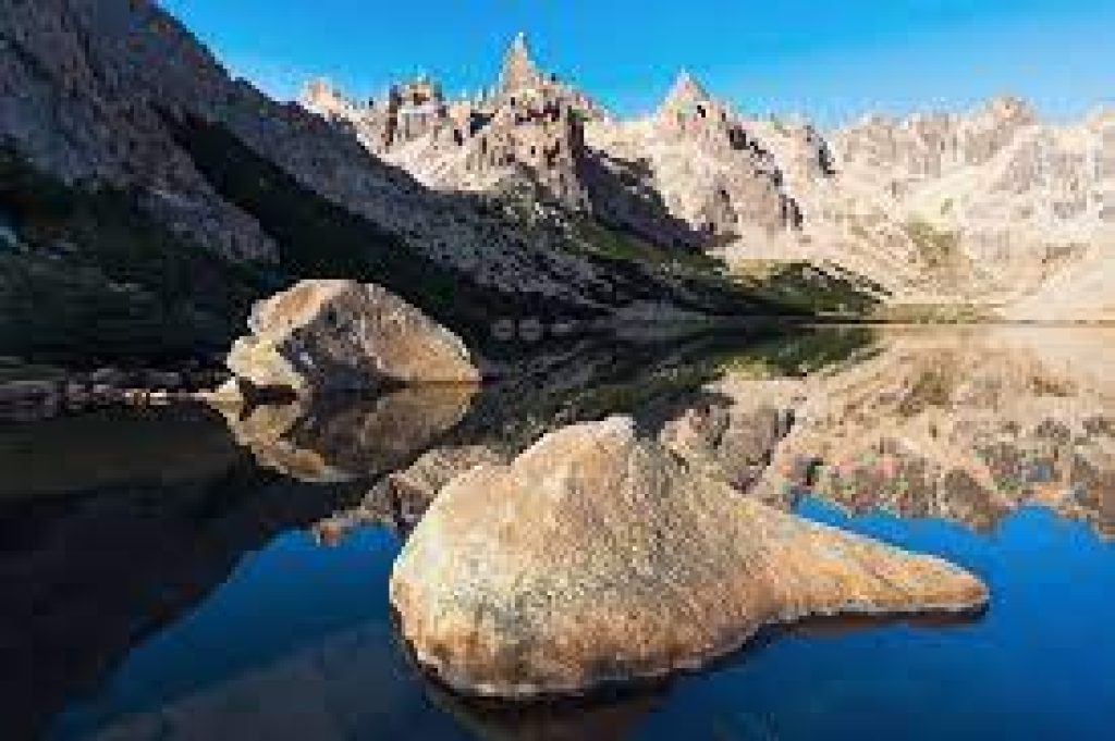
Refugio Frey and Cerro Catedral, nestled among Argentina’s beautiful landscapes, testify to the country’s natural splendor. These historic locations have become a haven for outdoor enthusiasts, particularly hikers looking for adventure and solitude in the heart of the Andes Mountains.
This article will thoroughly reference the history, description, hiking routes, challenges, and advice for exploring Refugio Frey and Cerro Catedral.
Brief History
Refugio Frey and Cerro Catedral are prominent sites in Argentina’s Patagonian region in the Nahuel Huapi National Park. Here’s a brief history of each:
Refugio Frey is a mountain lodge in the Cerro Catedral massif, part of the Andes mountain range. It is named after Otto Meiling, an Austrian mountaineer who settled in Argentina and helped to establish climbing in the region. In 1956, Meiling founded the refuge as a base for climbers and outdoor enthusiasts exploring the surrounding peaks and valleys.
Refugio Frey has been a famous location for rock climbers, hikers, and skiers, bringing tourists worldwide. The refuge provides lodging, minimal amenities, and a meeting spot for explorers looking to experience the raw splendor of the Andes.
Cerro Catedral: Cerro Catedral, which translates as “Cathedral Hill” in Spanish, is a significant peak in Argentina near Bariloche. It is located in the Andean Patagonian Range and has an elevation of around 2,388 meters (7,835 feet). Cerro Catedral is well-known for its beautiful natural landscapes and superb skiing.
Cerro Catedral’s history as a ski resort dates back to the early 1930s when a group of Norwegian immigrants brought skiing to the area. It immediately became a renowned winter sports destination due to its copious snowfall and various terrain. The ski resort grew over time, building new slopes, lifts, and services to meet the increasing number of visitors.
Cerro Catedral is now one of South America’s largest ski resorts, with diverse slopes for skiers and snowboarders of all ability levels. It has also earned recognition as a year-round tourism attraction, attracting visitors during warmer months to enjoy hiking, mountain biking, and other outdoor sports.
Refugio Frey and Cerro Catedral have played essential roles in fostering adventure tourism and outdoor recreation in Nahuel Huapi National Park, contributing to the region’s reputation as a destination for nature lovers and thrill seekers.
Description of the Sight
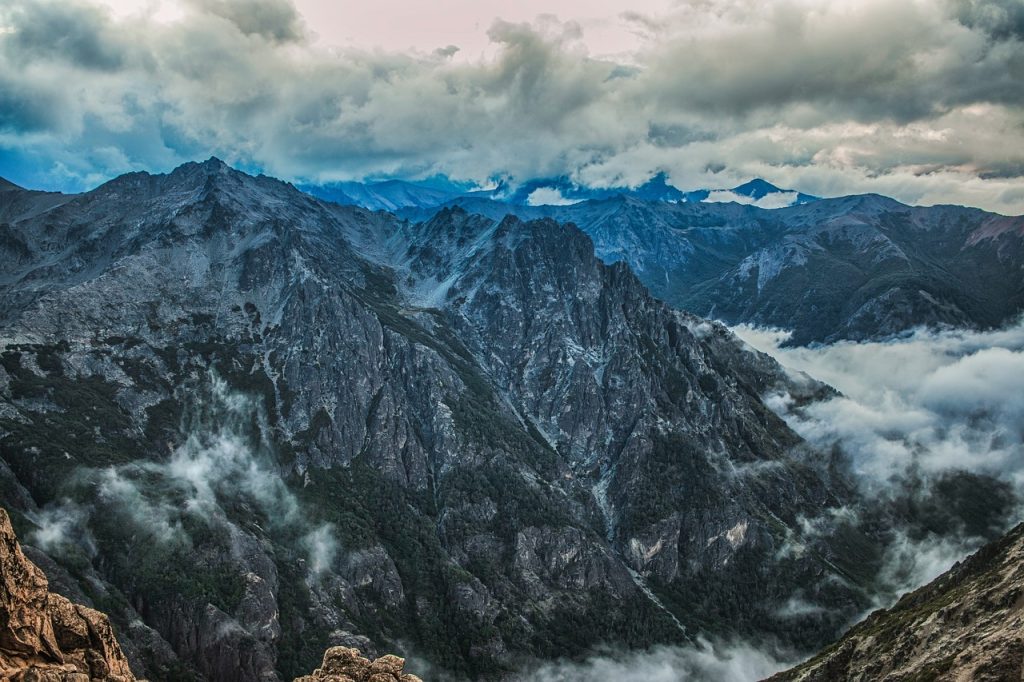
Refugio Frey and Cerro Catedral offer breathtaking natural landscapes and outdoor activities for adventurers and nature enthusiasts.
Refugio Frey is nestled in a picturesque valley surrounded by granite peaks, including Cerro Catedral. The refuge is a rustic mountain hut serving as a base camp for hikers, climbers, trekkers and skiers. The area is known for its rugged beauty, towering rock walls, glacial lakes, and alpine meadows.
Cerro Catedral is a prominent mountain in the Nahuel Huapi National Park and a popular destination for winter and summer activities. The ski resort offers over 120 kilometers of ski runs, catering to all skill levels. . The mountain changes into a hub for hiking, mountain biking, and rock climbing in the summer, providing access to beautiful panoramas and a rich ecosystem.
Ways to Get There
The Refugio Frey trailhead is in Cerro Catedral, a tiny skiing village about 20 kilometers from Bariloche.
There are several routes to the trailhead, including automobile, taxi, or public transportation. Taking public transportation is the most cost-effective choice.
Route of the Bus
Bus 55 is one of the buses that travels to Cerro Catedral. Bus 55 departs from Bariloche (Centro) between 7:15 am and 9:15 am. This bus only operates every 2 hours, so plan your return appropriately, especially if you complete this walk in one day.
Take the bus to the end of the route in Catedral, which takes about 35 minutes. The bus will stop you in the village, in front of a large parking area, the cable car, and a few businesses. The trailhead is across the parking lot on the gravel road, marked with “Frey” signage.
Details on hiking Refugio Frey and Cerro Catedral, Argentina
Hiking in Refugio Frey and Cerro Catedral allows you to enjoy the region’s outstanding natural beauty as well as its hard terrain. Here are some details about hiking in these areas:
Refugio Frey:
Hiking Trails: The most popular trail from the base of Cerro Catedral to Refugio Frey takes approximately 4-5 hours to complete. The trail provides stunning views of the nearby mountains, including the iconic granite walls.
Difficulty Level: The trail to Refugio Frey is moderately difficult, with some steep stretches and rocky terrain. It is recommended for hikers with a moderate level of fitness and experience.
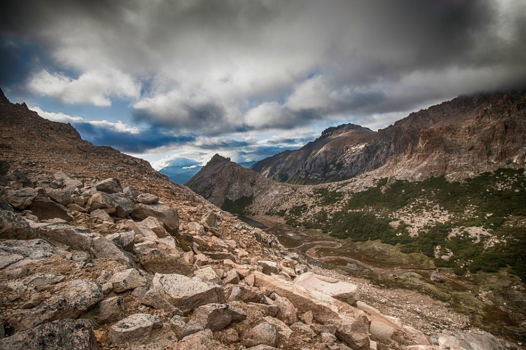
Highlights: Along the trail, hikers will pass by beautiful glacial lakes, including Laguna Tonček, a popular spot for a rest and a picnic.
Duration of Stay: Many hikers choose to spend a night or two at Refugio Frey to explore the area further or attempt rock climbing routes.
Cerro Catedral:
Hiking Trails: Cerro Catedral offers a range of hiking trails suitable for different skill levels. The trails vary in length and difficulty, providing options for casual day hikes or longer multi-day treks.
Highlights: Hiking in Cerro Catedral also provides breathtaking views of the surrounding mountains, lakes, and woods. The trails often pass through alpine meadows and offer opportunities to spot wildlife.
Popular Routes: Some popular hiking routes in Cerro Catedral include the Laguna Schmoll Trail, the Van Titter Valley Trail, and the hike to the summit of Cerro Catedral itself.
When to Go: Weather and Season
The optimum time to visit Refugio Frey and Cerro Catedral in Argentina is determined by the activities you intend to partake in:
Winter (June to August):
Cerro Catedral’s peak season for skiing and snowboarding. During this time, the mountain receives a lot of snow, making for ideal winter sports conditions. The ski resort is buzzing with activity, and guests can enjoy a variety of slopes and paths ideal for all skill levels. The weather is often cold, with temperatures ranging from freezing to below freezing, so dress appropriately for the season.
Spring (September to November):
Spring is a season of transition in the region. The snow starts to defrost, and the weather begins to warm up. It’s an excellent time to visit if you prefer skiing in softer snow or exploring the hiking paths surrounding Refugio Frey as the snow melts. However, it should be noted that weather conditions can still be unexpected, with snowfall or colder days possible.
Summer (December to February):
The region experiences milder temperatures and longer daylight hours during the summer. It is an excellent time to explore the hiking routes, view the breathtaking scenery, and participate in outdoor activities near Refugio Frey and Cerro Catedral. At higher levels, the snow melts, revealing beautiful green valleys and alpine meadows.
Autumn (March to May):
Cerro Catedral and Refugio Frey are known for their magnificent fall foliage as the leaves change colors. The weather continues to decrease, and the crowds begin to thin, giving it a more peaceful time to visit. Autumn is an excellent season to go trekking and enjoy the tranquillity of the mountains. However, remember that weather conditions might change, so check predictions and bring layers of clothing to meet shifting temperatures.
Accommodation
There are numerous possibilities for lodging in Argentina when visiting Refugio Frey and Cerro Catedral, depending on your interests and level of comfort. Here are several possibilities:
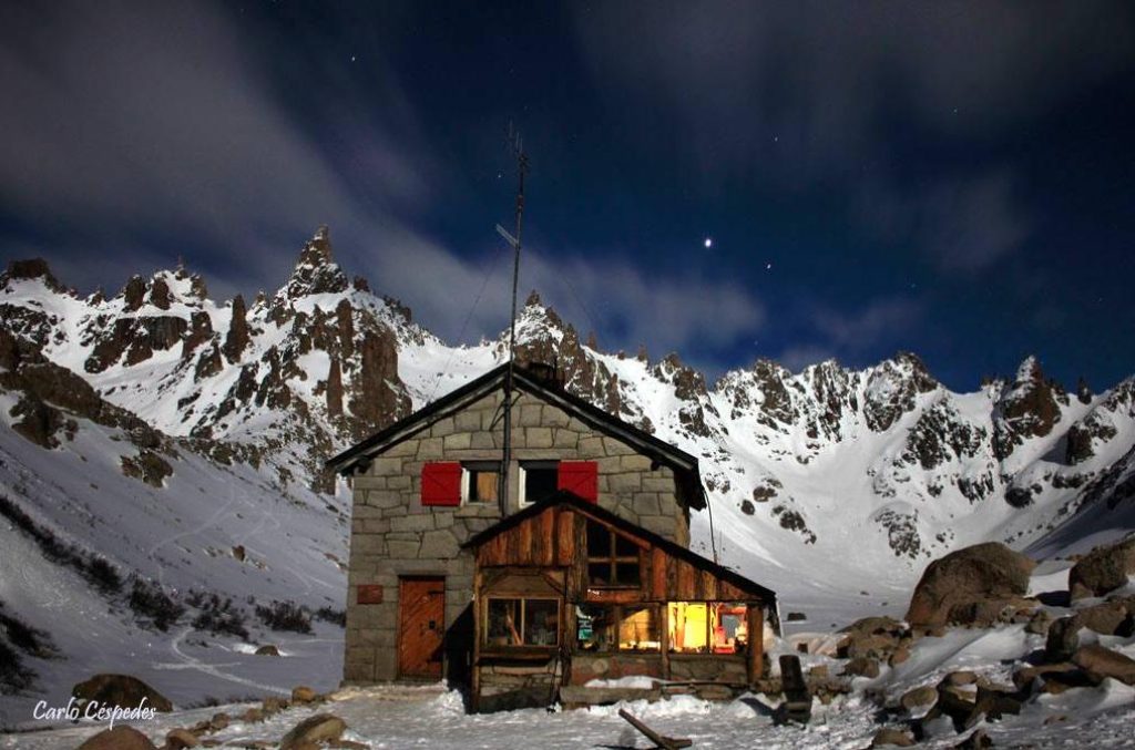
photo: Carlos Cespedes.
Refugio Frey:
If you intend to remain near Refugio Frey, the refuge provides minimal lodging in dormitory-style bunk beds. It’s a primitive mountain lodge offering outdoor enthusiasts a unique and immersive experience. Remember that the refuge might get crowded during peak seasons, so make reservations beforehand.
Bariloche:
Bariloche, located near Cerro Catedral, has a variety of lodging alternatives to meet a variety of budgets and preferences. You’ll find something to suit your needs, from luxury hotels and resorts to budget-friendly hostels and vacation rentals.
Mountain Lodges and Cabins:
Mountain lodges and cabins are available near Cerro Catedral and Refugio Frey. These rooms provide a more isolated and natural experience. Lodges and cabins with varied levels of comfort and amenities are available, ranging from cozy and rustic to more opulent options. Some resorts are in the forest, providing breathtaking views of the mountains and lakes.
Camping:
If you choose a more adventurous and cost-effective option, camping is available in Nahuel Huapi National Park. There are designated campsites where you can pitch your tent and enjoy the region’s natural beauty. However, before camping, check the restrictions and secure any necessary licenses.
When selecting your hotel, consider variables like closeness to your desired activities, amenities, and personal comfort and convenience preferences.
Food and Water
When hiking in Refugio Frey and Cerro Catedral, it’s essential to plan for food and water:
Refugio Frey: Refugio Frey has a communal kitchen where hikers can prepare meals. It’s necessary to bring your food supplies, including non-perishable items such as dried fruits, nuts, energy bars, and dehydrated meals. Packaging a stove and cooking utensils is also recommended if you plan to cook hot meals.
Cerro Catedral: In the base area of Cerro Catedral, there are restaurants and cafes where you can enjoy meals and refreshments. However, when hiking the trails, carrying your own food and water is advisable. Pack lightweight, nutrient-dense snacks and sufficient water to stay hydrated during your hikes.
Tips to know when hiking Refugio Frey and Cerro Catedral, Argentina
Here are some tips to enhance your hiking experience in Refugio Frey and Cerro Catedral:
- Plan and Prepare: Research the trails, understand their difficulty levels, and plan your hikes accordingly. Check weather conditions, pack appropriate clothing and gear, and inform someone about your itinerary.
- Start Early: Begin your hikes early in the day to allow ample time for your planned route and to avoid potential afternoon thunderstorms or adverse weather conditions.
- During the winter, the lake at Refugio Frey will be frozen.
- Notice that fewer people and fewer shops will operate during the summer months.
- If you want to camp, the campsite is free. If you choose to stay in the refuge, a mattress may be rented for roughly USD 14. The Refugio can accommodate 35 to 40 people at once, but reservations are required and can be obtained at the Park Info Center in Bariloche.
Potential Dangers
When visiting Argentina’s Refugio Frey and Cerro Catedral, it’s critical to be aware of potential hazards and take the required measures.
Weather: The weather condition in the region can be variable and change quickly, particularly in the mountains. It is critical to check weather forecasts before venturing out and to be prepared for rapid temperature fluctuations, high winds, and probable storms. Dress in layers, have proper clothing, and be prepared to change your plans if the weather worsens.
Altitude and Acclimatization: Cerro Catedral reaches enormous altitudes, and if you intend to trek or climb at greater levels, you may encounter altitude-related difficulties. It is critical to properly acclimate by gently ascending and allowing your body to adjust to the thinner air. Stay hydrated, be in the know of altitude sickness symptoms, and descend if they intensify.
Mountain Dangers: The mountainous topography of Cerro Catedral and its surroundings can be dangerous. Slopes, loose rocks, and cliffs necessitate caution and good navigation abilities. If you intend to go mountaineering, rock climbing, or backcountry skiing, ensure you have the requisite abilities, experience, and gear. If you’re new to these activities, go with a qualified guide.
Avalanches: Avalanches are possible in the backcountry areas surrounding Cerro Catedral during winter. Suppose you intend to go off-piste or explore unmarked regions. In that case, you must be familiar with avalanche safety, which includes evaluating snow conditions, carrying adequate rescue equipment, and going with experienced partners.
Conclusion
Argentina’s Refugio Frey and Cerro Catedral provide a fantastic trekking experience for nature lovers and explorers. The breathtaking vistas, rugged terrain, and allure of the Andes Mountains make it a must-see hiking destination. Visitors can start a memorable adventure through this remarkable region if they grasp the history, prepare sufficiently, and know the challenges and potential risks. The memories and experiences gained from hiking in this Argentine beauty will last a lifetime, whether exploring the craggy cliffs of Refugio Frey or reaching the summit of Cerro Catedral.